Lazy Toad Web Pages
Toad Photo Galleries Trails
- Barnwell Mountain
- Black Gap
- Blackrock Desert
- EDRA: Hwy 101
- Elephant Hill
- Engineer Pass
- Fins N Things
- The Maze
- Metal Masher
- Poison Spider/
Golden Spike/
Gold Bar Rim - Rimrocker
- The Rubicon
- Schnebly Hill
- Top of the World
- Toroweap
- White Rim
Other
Team Toad: Hiking to the Harvest Pictograph
Okay, with that out of the way, this is a long story about me deciding that I really wanted to take a picture of something, the hard work I did to get there, how I got into trouble, and how several people worked together to rescue me.
Acknowledgements: thanks to Tony Woodward, Barbara and David Rainey, Scotty Maxwell, and Wendy Estrada, for exemplifying what it means to be a Jeeper.
Outline:
- Start
- The Harvest Scene
- Preparation
- Gear
- Theory and Practice
- Trouble
- Rescue
- Tony's Climb
- Lessons
- The Ancient Ones
Start
The story starts in October 2022 when I was in the Reno area to drive the Emigrant Trail.
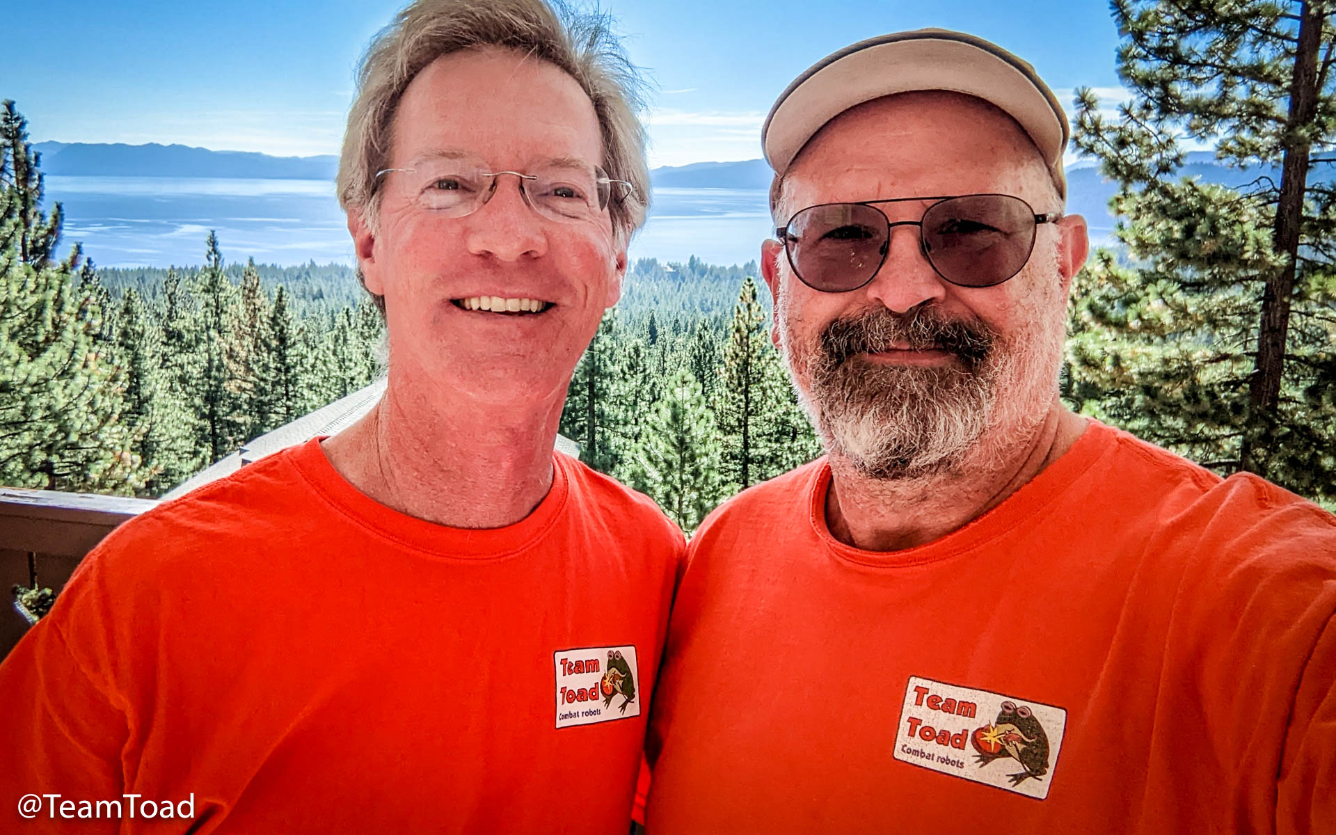 |
Tony Woodward has been a member of Team Toad since Robogames in 2016, having been recommended by his aunt, Barbara Rainey. I visited Tony at his home on Lake Tahoe, and then Barbara and David Rainey at their ranch in Reno. |
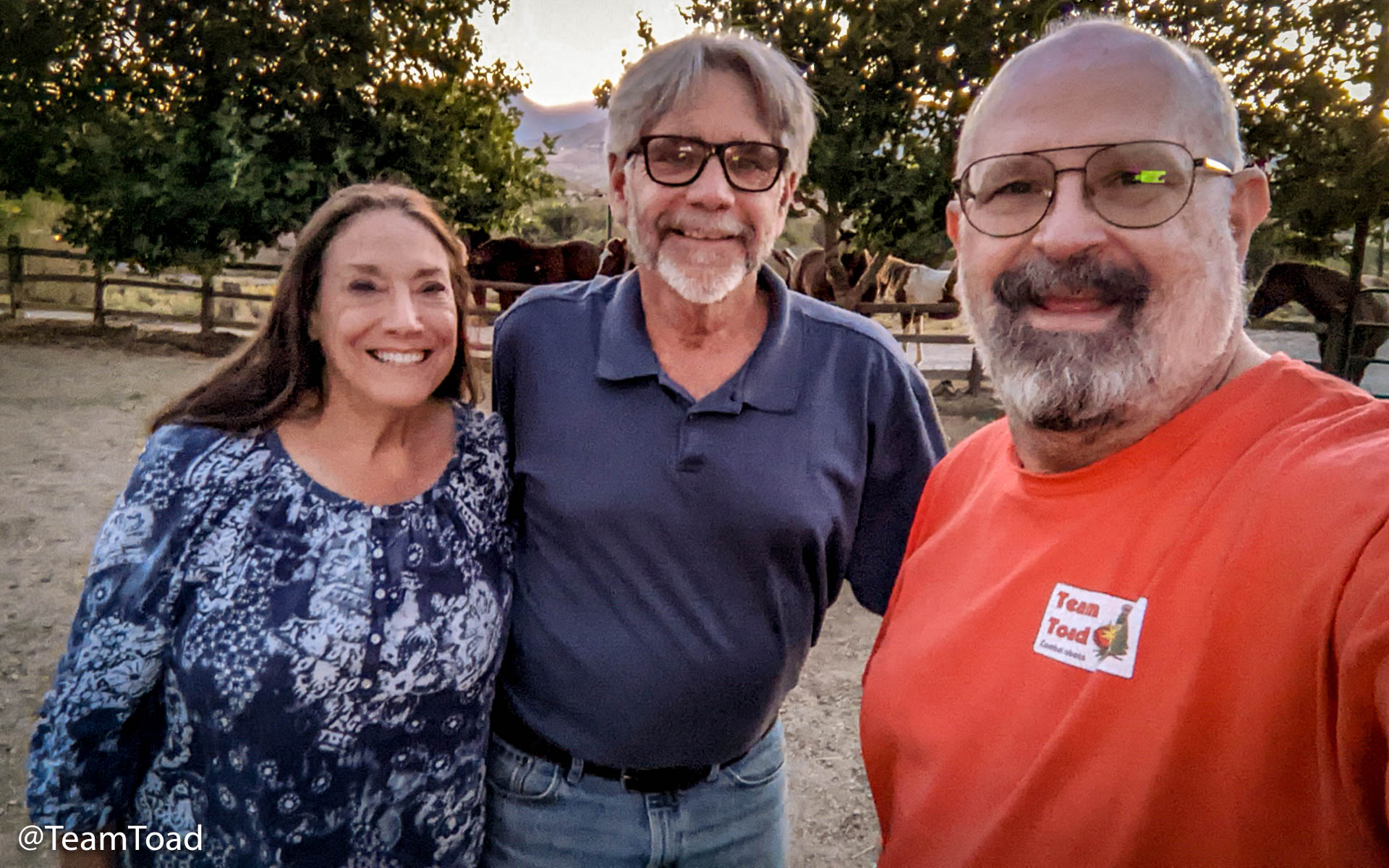 |
Barbara and David and I had previously Jeeped together in the Island in the Sky district of Canyonlands, and wanted to plan another trip.
They both have a lot more Jeep experience than I do, but there was one place I'd been to twice that they'd never seen: The Maze District of Canyonlands. It would give me a chance to lead a Jeep trip for the first time.
So we got out their calendar and found the first date we could get together: the latter part of June, eight months away (the Raineys are really busy people).
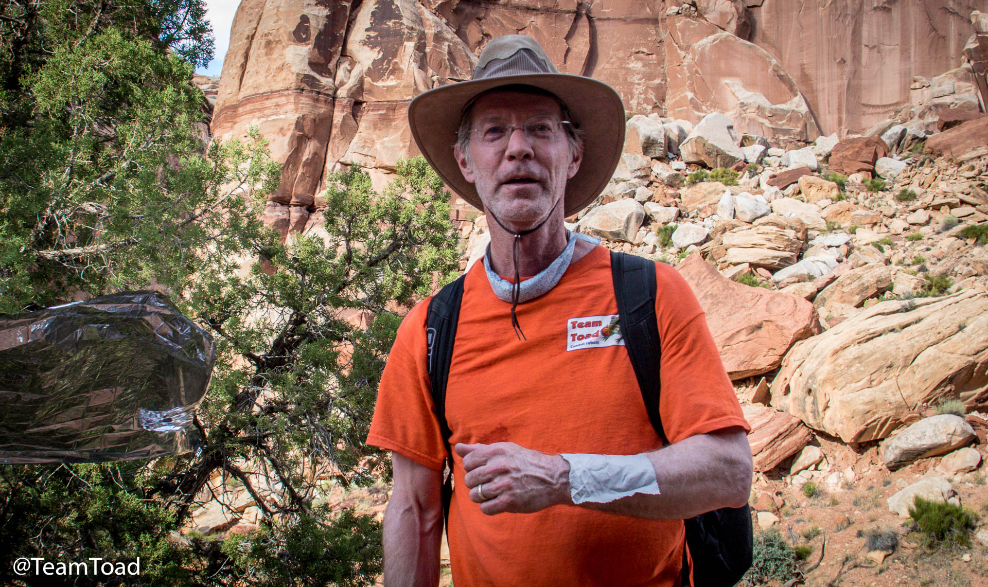
I wrote that down in my calendar in ink, and started planning. In February I got reservations for the necessary backcountry camping permit. Somewhere along the way, I was discussing the trip with Tony, and invited him to ride along with me on the trip. That turned out to have been a really good idea to have him along.
I made reservations for camps at the Maze Overlook, Chimney Rock, and Dollhouse.
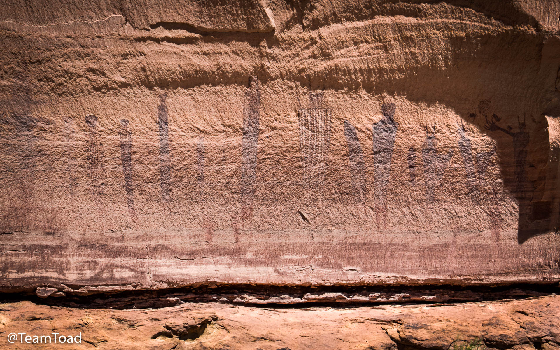
The Harvest Scene
The Canyonlands part of Utah has been populated by different groups of people throughout history, including paleoindians, archaic people, and the Fremont people (DeMille, 2017).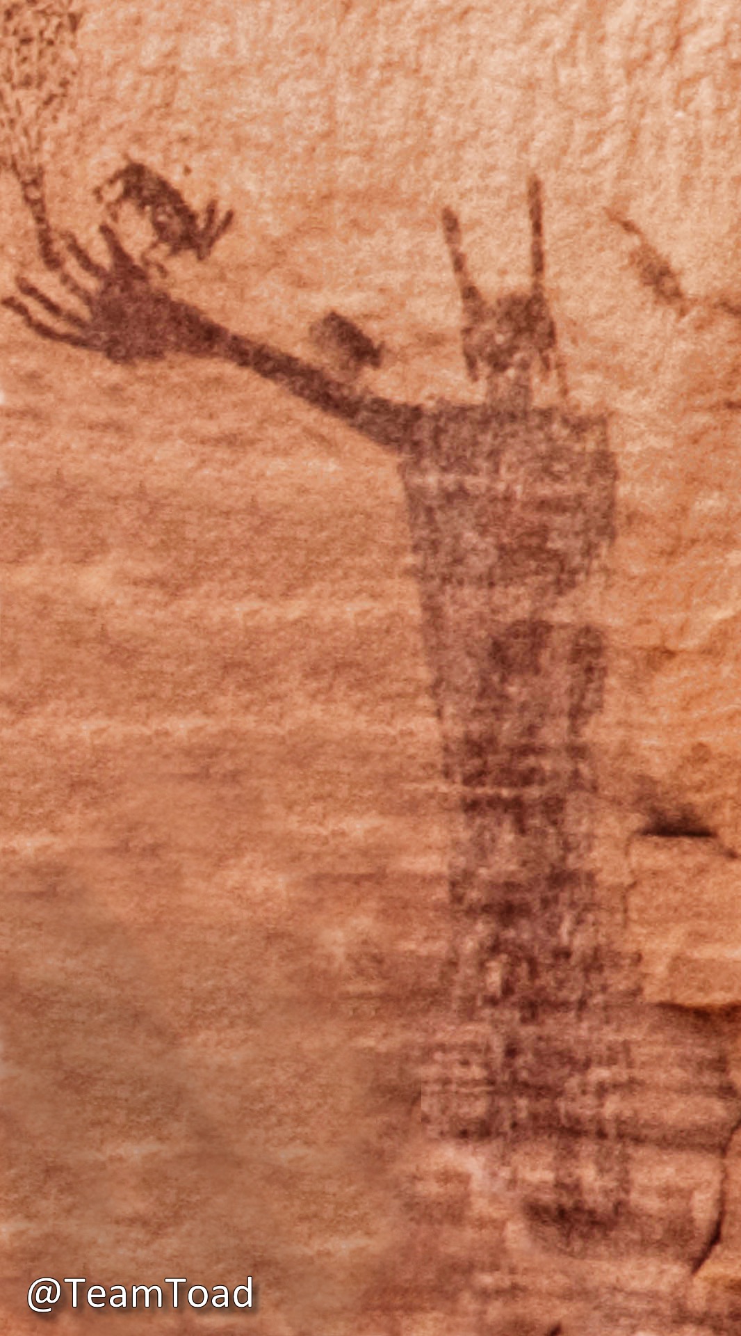 Found throughout this area are ancient images called
Barrier Canyon Style. Pictographs are painted images, and petroglyphs are actually
carved into the rock by pecking with another rock.
Found throughout this area are ancient images called
Barrier Canyon Style. Pictographs are painted images, and petroglyphs are actually
carved into the rock by pecking with another rock.
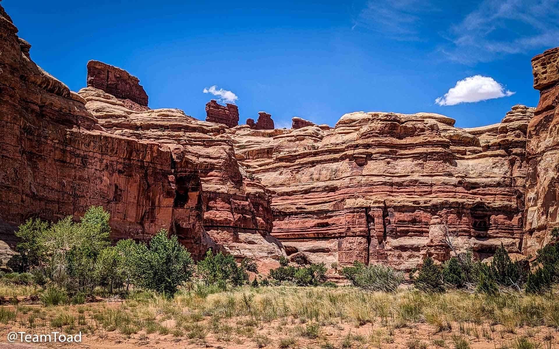
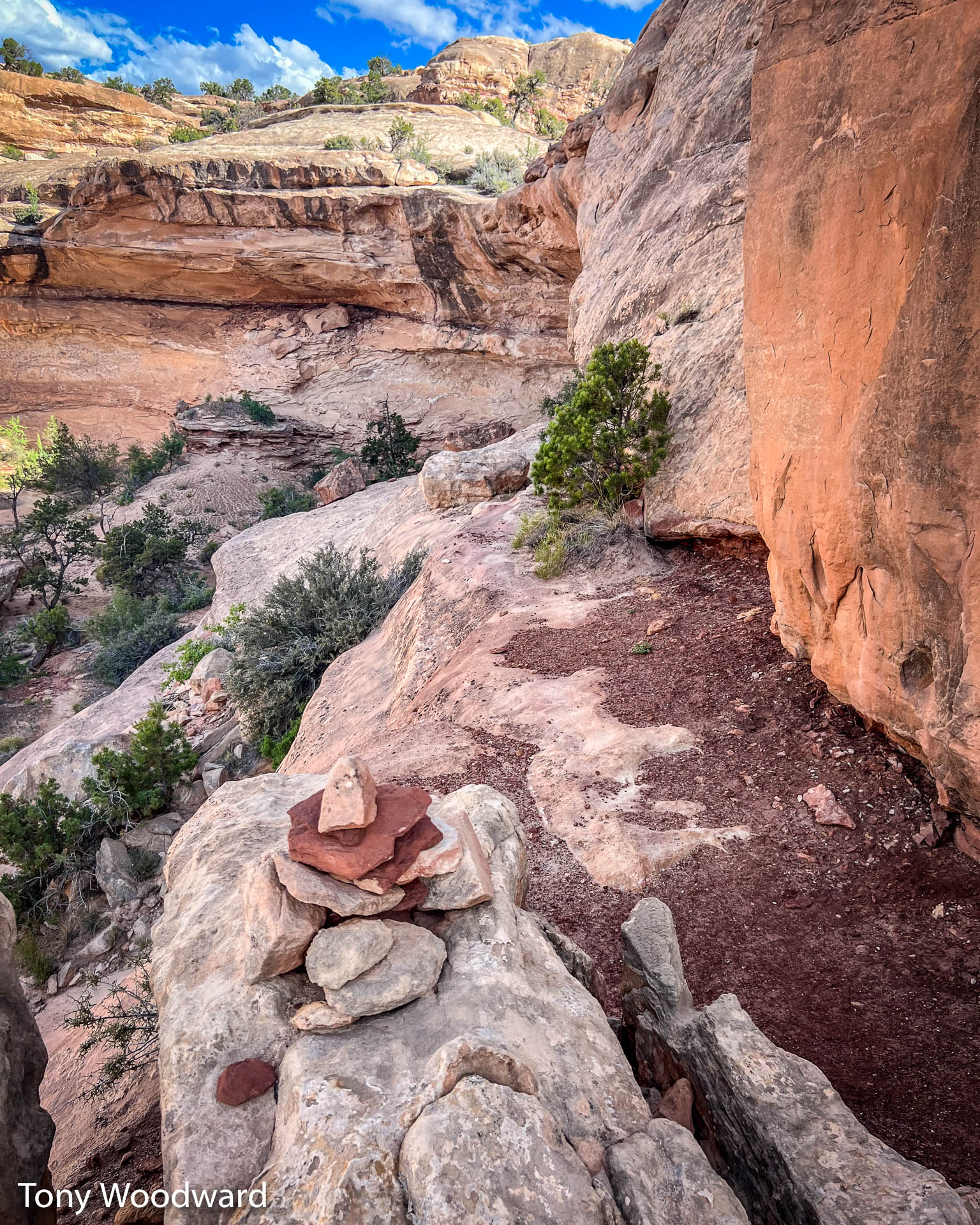
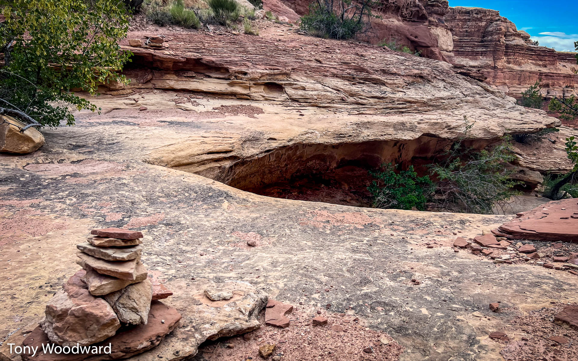
About one mile from the Maze Overlook camp, and two and a half miles from Chimney Rock there is a large canyon wall painted with ancient figures called "The Harvest Scene", estimated to have been painted between 4,000 and 1,500 years ago.
For more reading about ancient art in Utah, see Jacobs, figures.
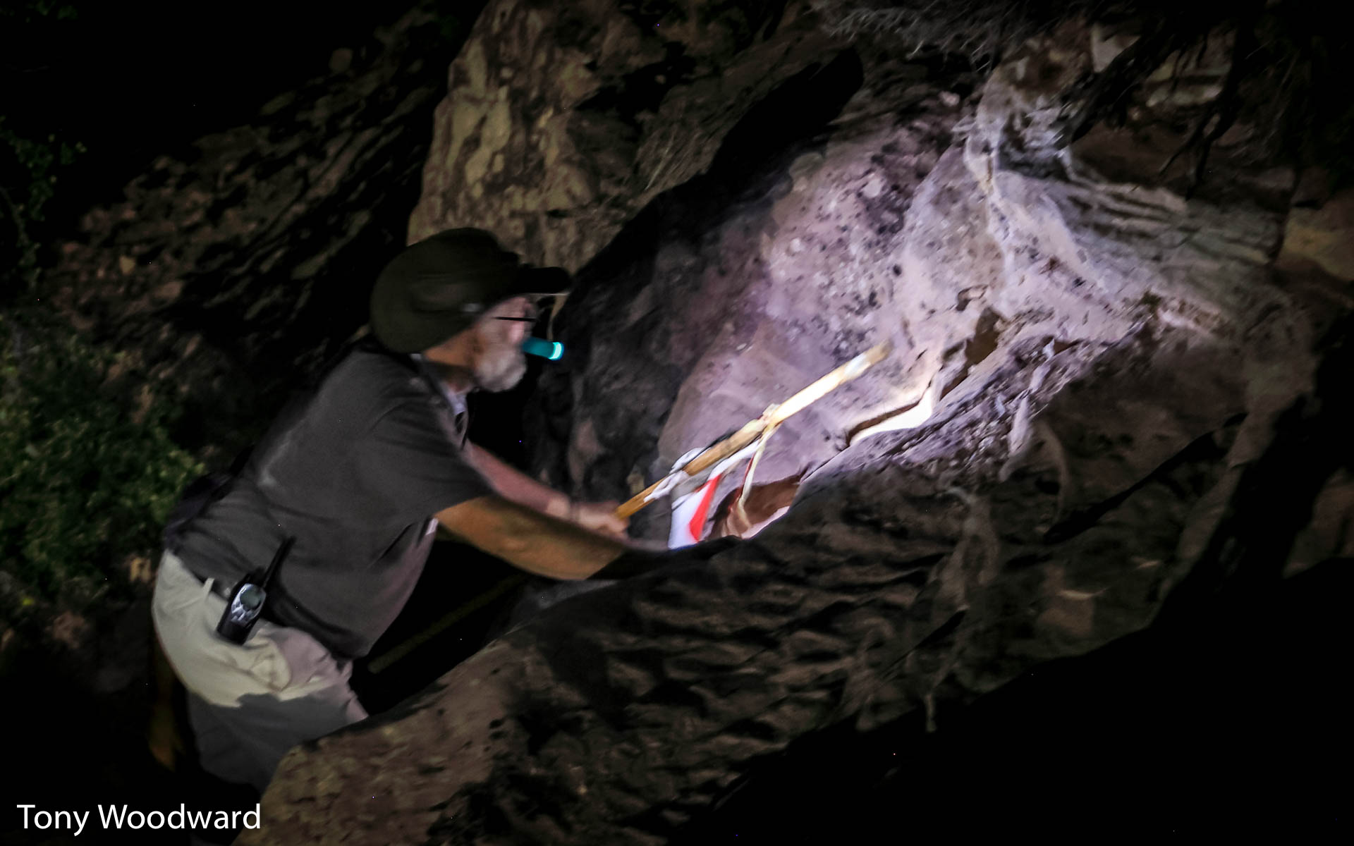
For reasons unexplained, I decided that I wanted to photograph this pictograph.
Preparation
 Hiking in 2014 |
This wasn't my first hike in the Maze. In 2014 I hiked from the Dollhouse all the way past the Spanish Bottom down to the Colorado River. | 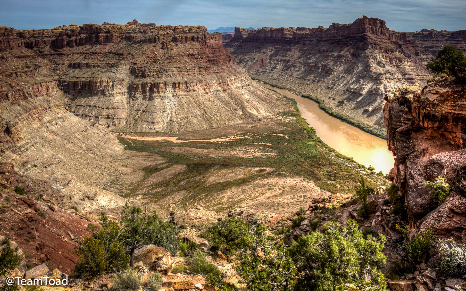 One thousand feet above the Spanish Bottom and the Colorado River |
So I knew all about rock cairns and climbing down to climb back up. Of course, in the meantime I was 9 years older, and 30 pounds heavier.
 As soon as we had the camping permits in February, I started walking to
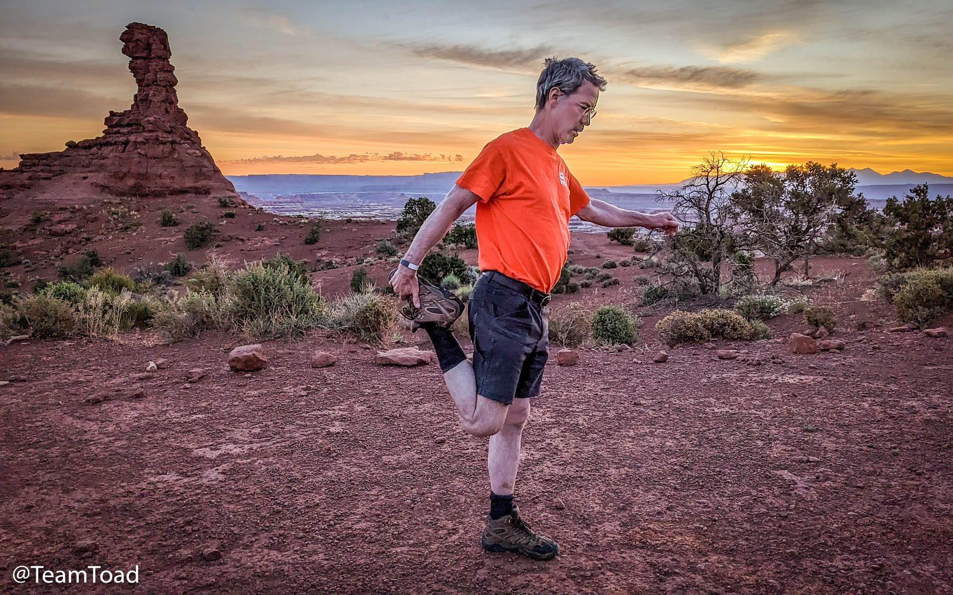
get in shape for the hike.
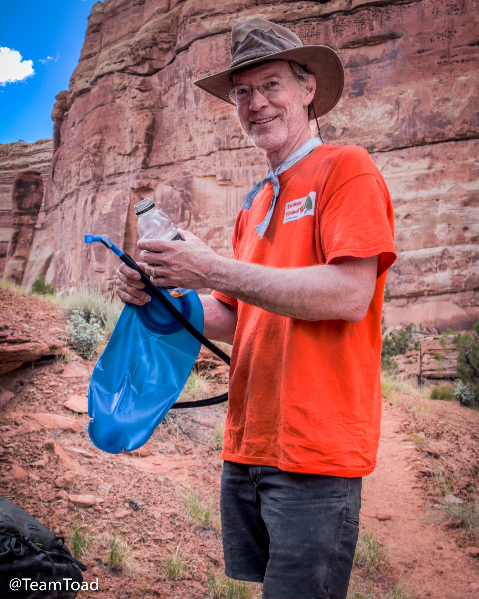
As you can see in the photo, I made sure to wear my CamelBak for training.
As soon as we had the camping permits in February, I started walking to
get in shape for the hike.
As you can see in the photo, I made sure to wear my CamelBak for training.
You can't see that I'm wearing my two year old Timberland boots (Mens Chocorua Trail 2.0 Waterproof Hiking Chukka Boot). I keep several pairs of these boots in rotation for ranch work, because the worst feeling in the world is hiking in new boots.
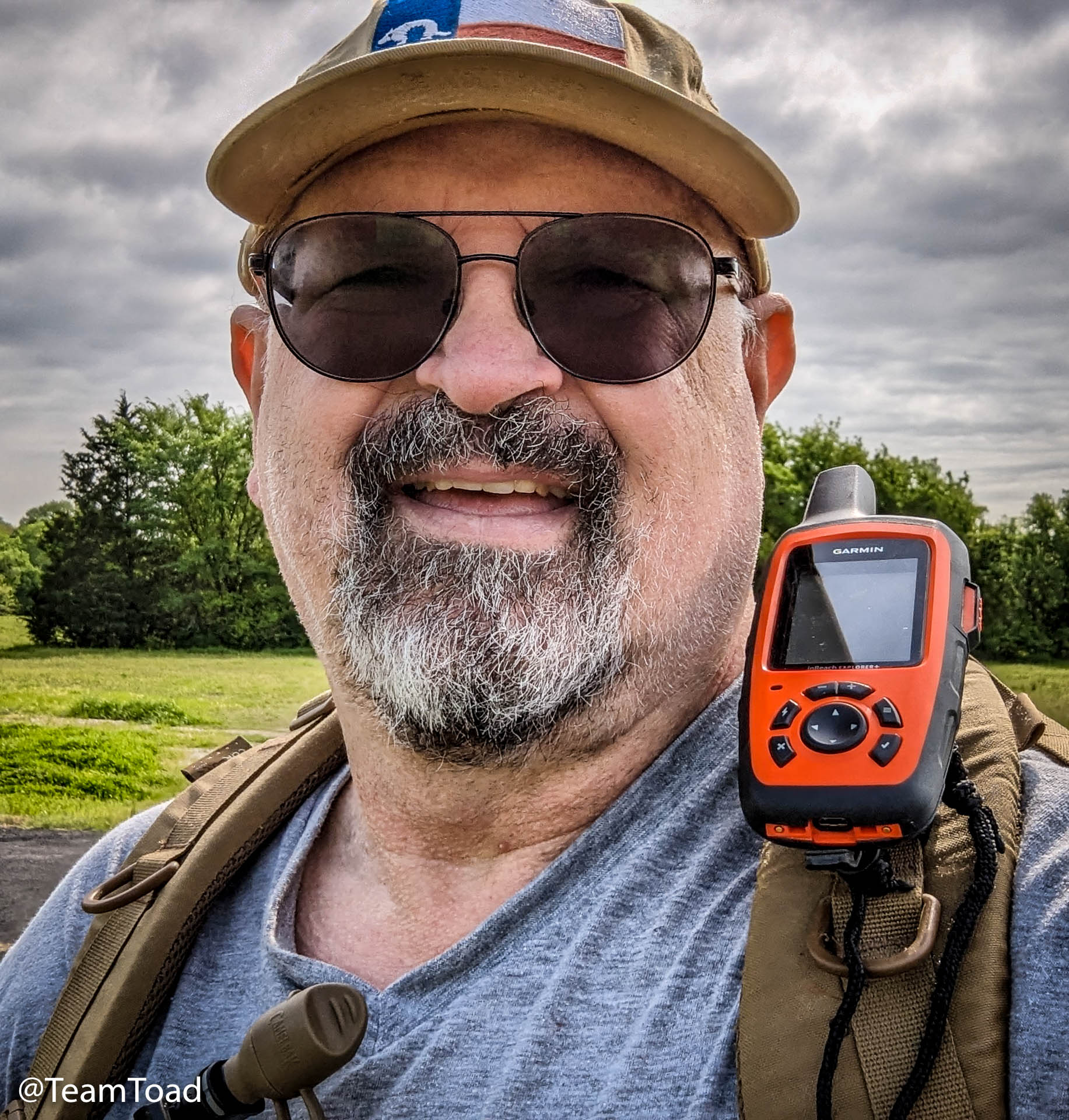
You can see that I've upgraded to the InReach Explorer+, which has a much nicer map capability. It meant I could upload the planned hiking trail into the InReach, and could be certain not to get lost.
The biggest change I made, though, was giving up sweet iced-tea, soda, and other sugary drinks. That one change caused me to lose 25 pounds before the hike... which was more than my pack weighed.
I didn't train as much or as hard as I should have, because
- My knees hurt when I walked too often in the week, and
- I am lazy.
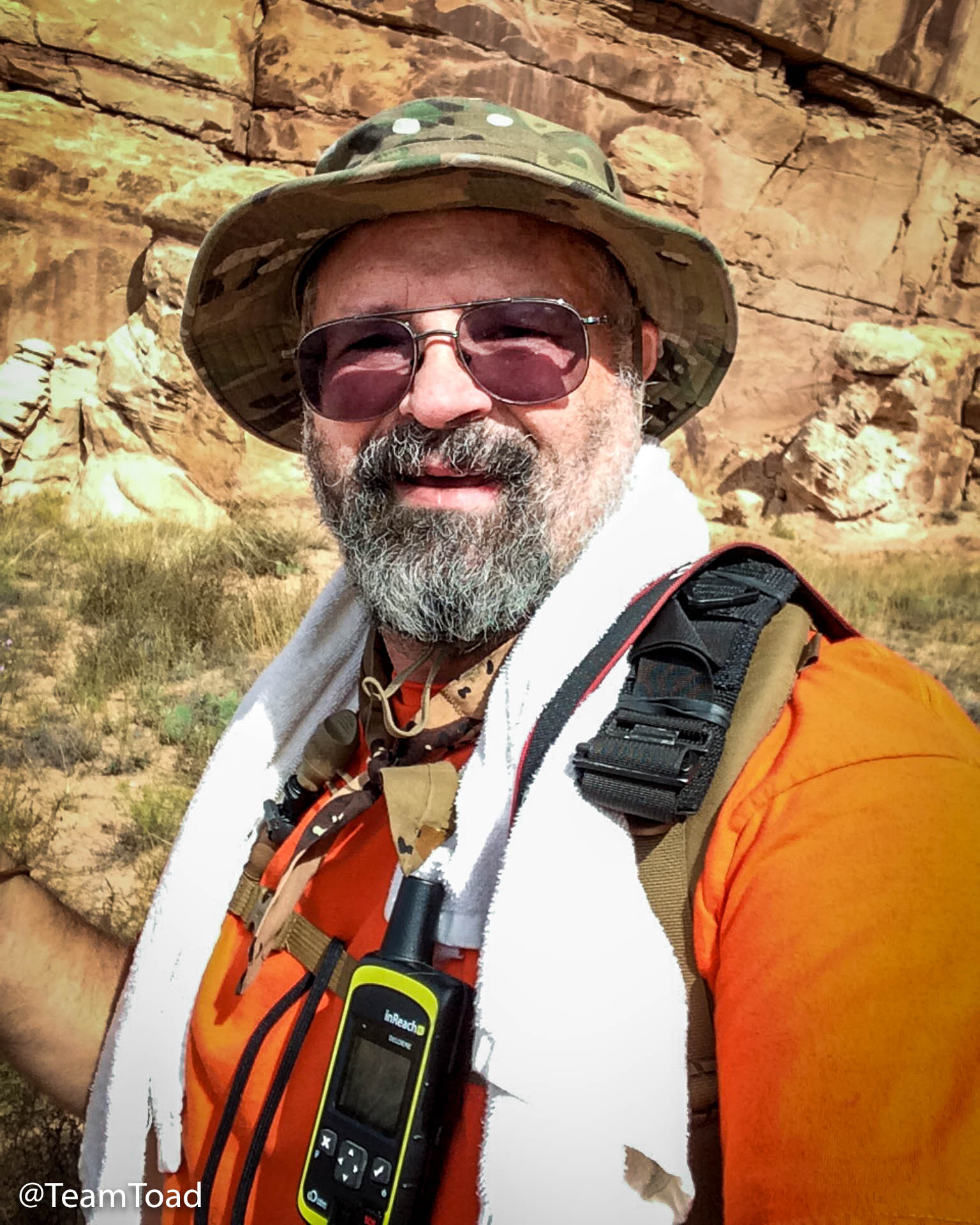
Gear
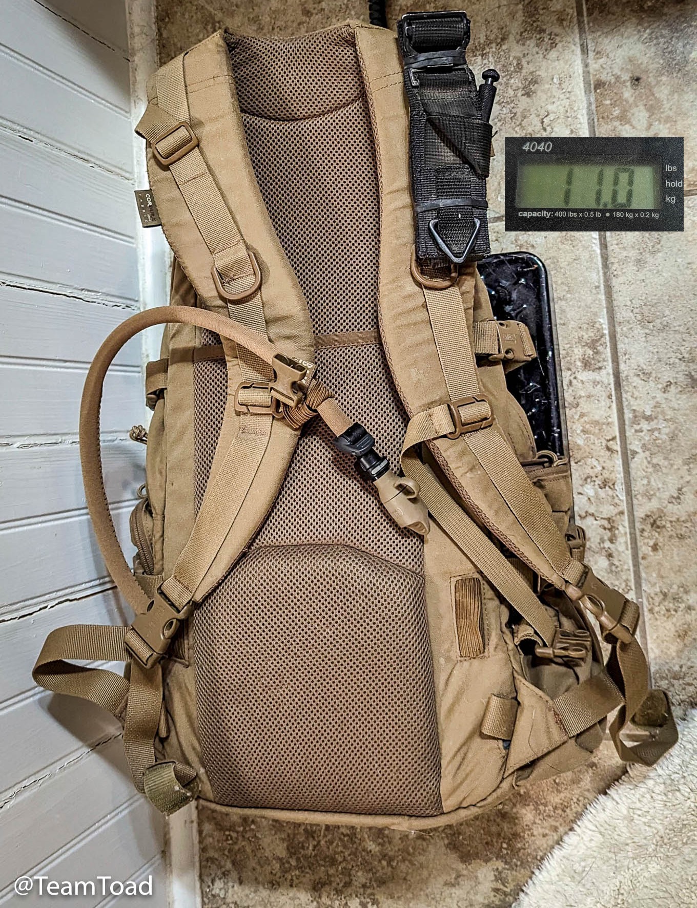 I've used the same day pack for a decade now... it's a
CamelBak "Linchpin", and sadly it is not made
any more (fortunately you can still buy replacement
"Antidote" bladders for it). It's perfect for carrying
a camera and a couple of lenses, supplies, and water for a day hike.
With a full 3.0L bladder it weighs 11 pounds.
I've used the same day pack for a decade now... it's a
CamelBak "Linchpin", and sadly it is not made
any more (fortunately you can still buy replacement
"Antidote" bladders for it). It's perfect for carrying
a camera and a couple of lenses, supplies, and water for a day hike.
With a full 3.0L bladder it weighs 11 pounds.
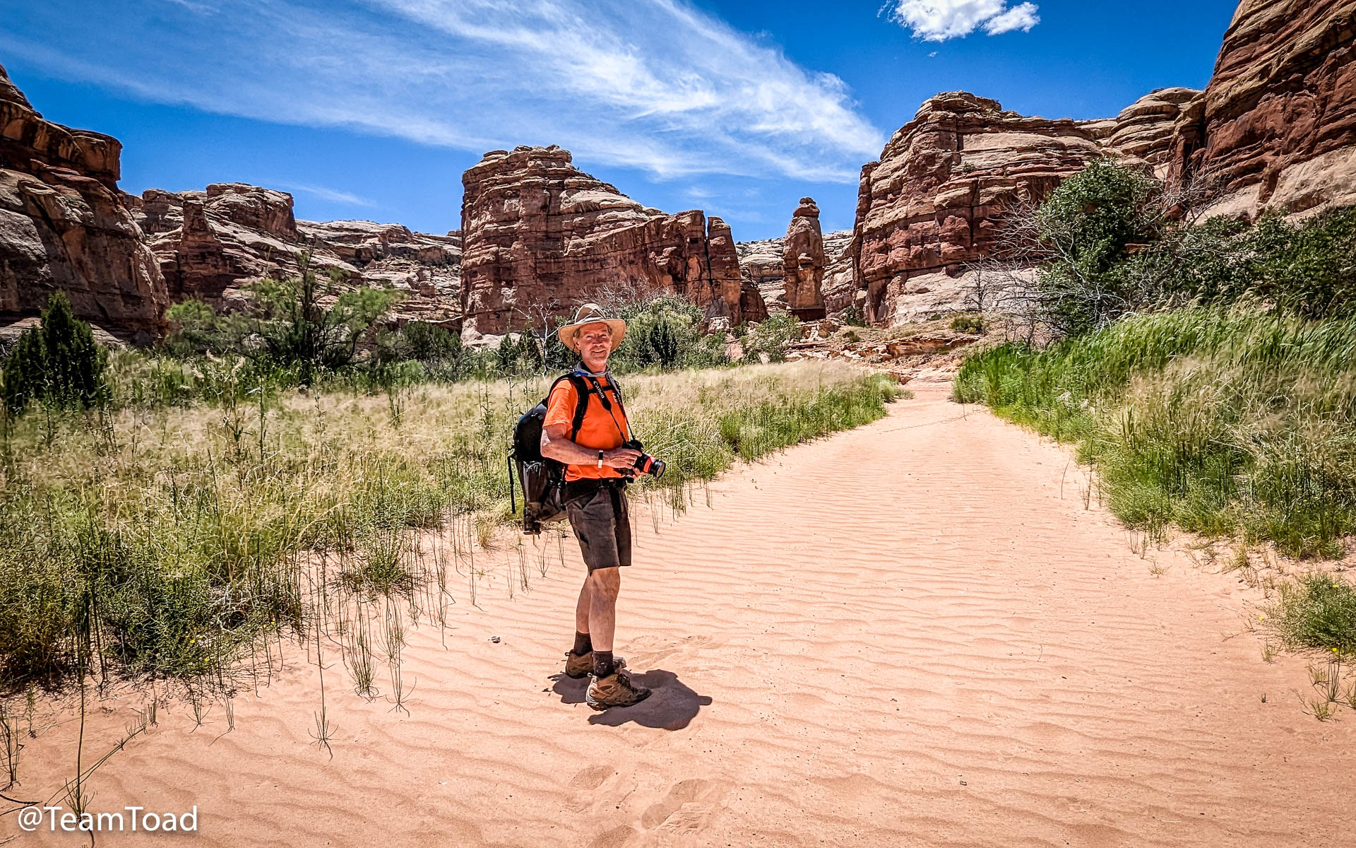
I started packing my backpack in May, and tried to make good decisions so as to avoid "mission creep" and unnecessary weight:
- Two (2) 20 ounce bottles of frozen orange Gatorade
- Paper maps of the Maze, and USGS topo maps
- InReach Explorer+ and backpack strap mount
- Midland GMRS handheld
- SOF-T-Wide tourniquette mounted on backpack strap
- Small EDC trauma kit (ITS Tactical)
- Small first aid kit plus mole skin
- An extra pair of socks
- One camera and lens (Canon 7d2 with 18-200mm zoom)
- Battery pack for camera
- 60 feet of paracord
- Two (2) mylar "Space Blankets"
- One WAG bag, small roll toilet paper, and ZipLoc with a few wet wipes
- Medium-sized trash bag
- One flashlight
- One Ridge Runner folding knife
- One small tube SPF 50 suntan lotion
- One small bottle of DEET
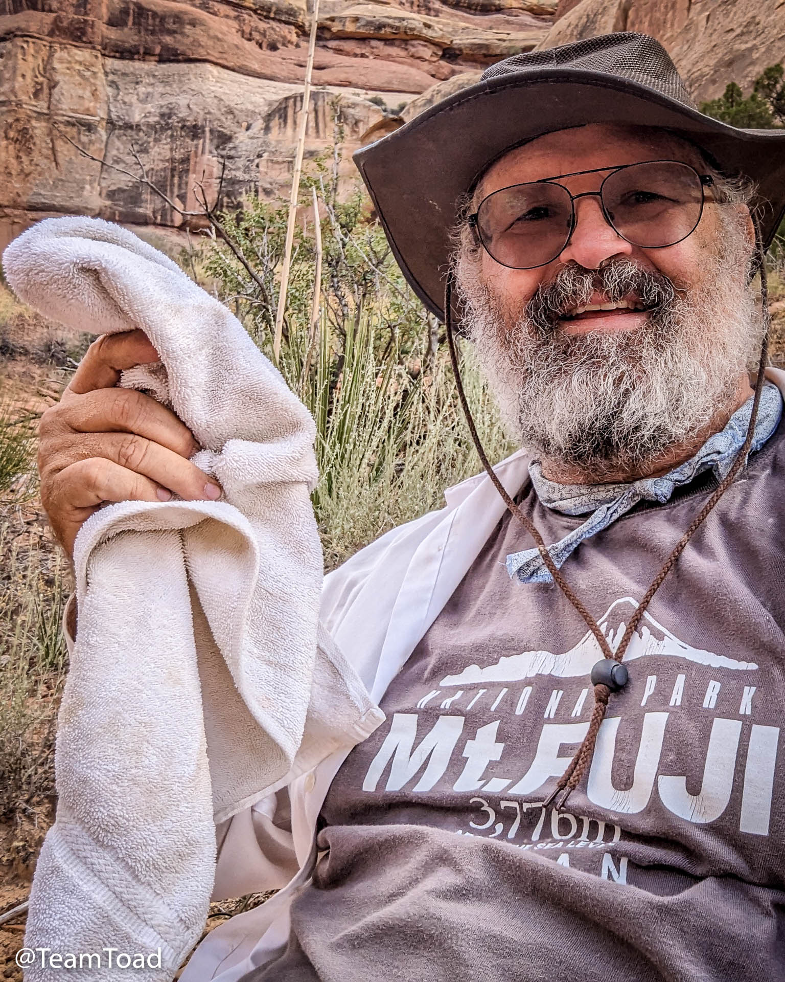
- One fluffy hand towel
- A six inch frozen Subway sandwich and a few beef sticks
- Tripod (Tony was bringing his)
- Headlamp
- Second camera back and lens
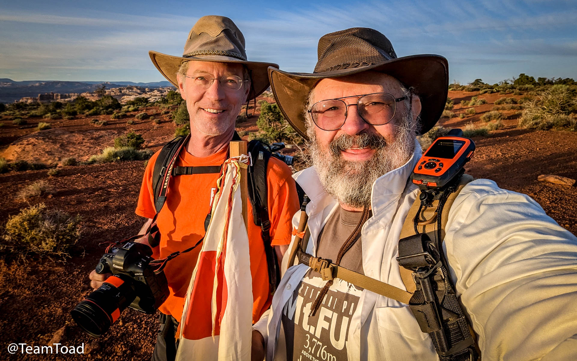
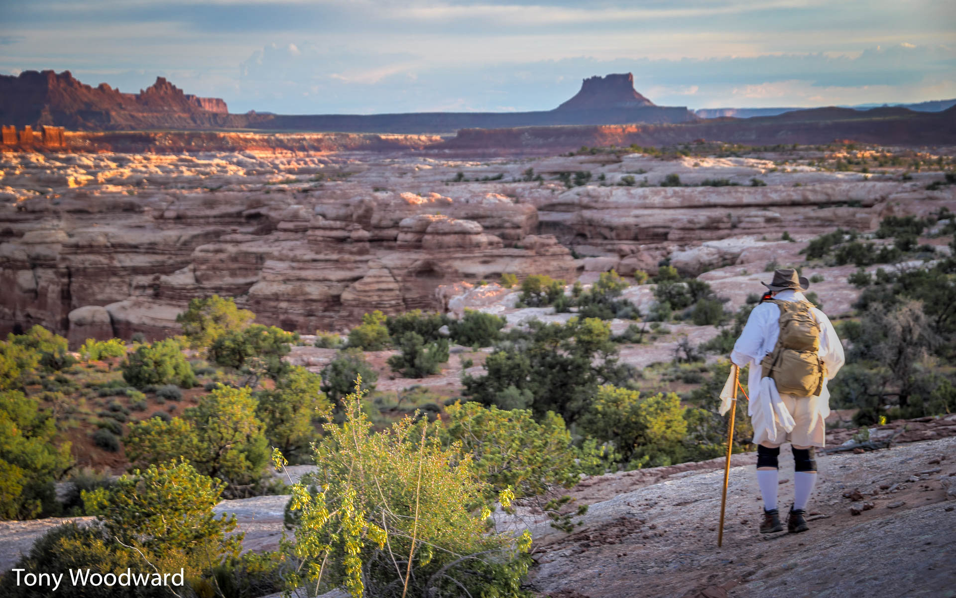
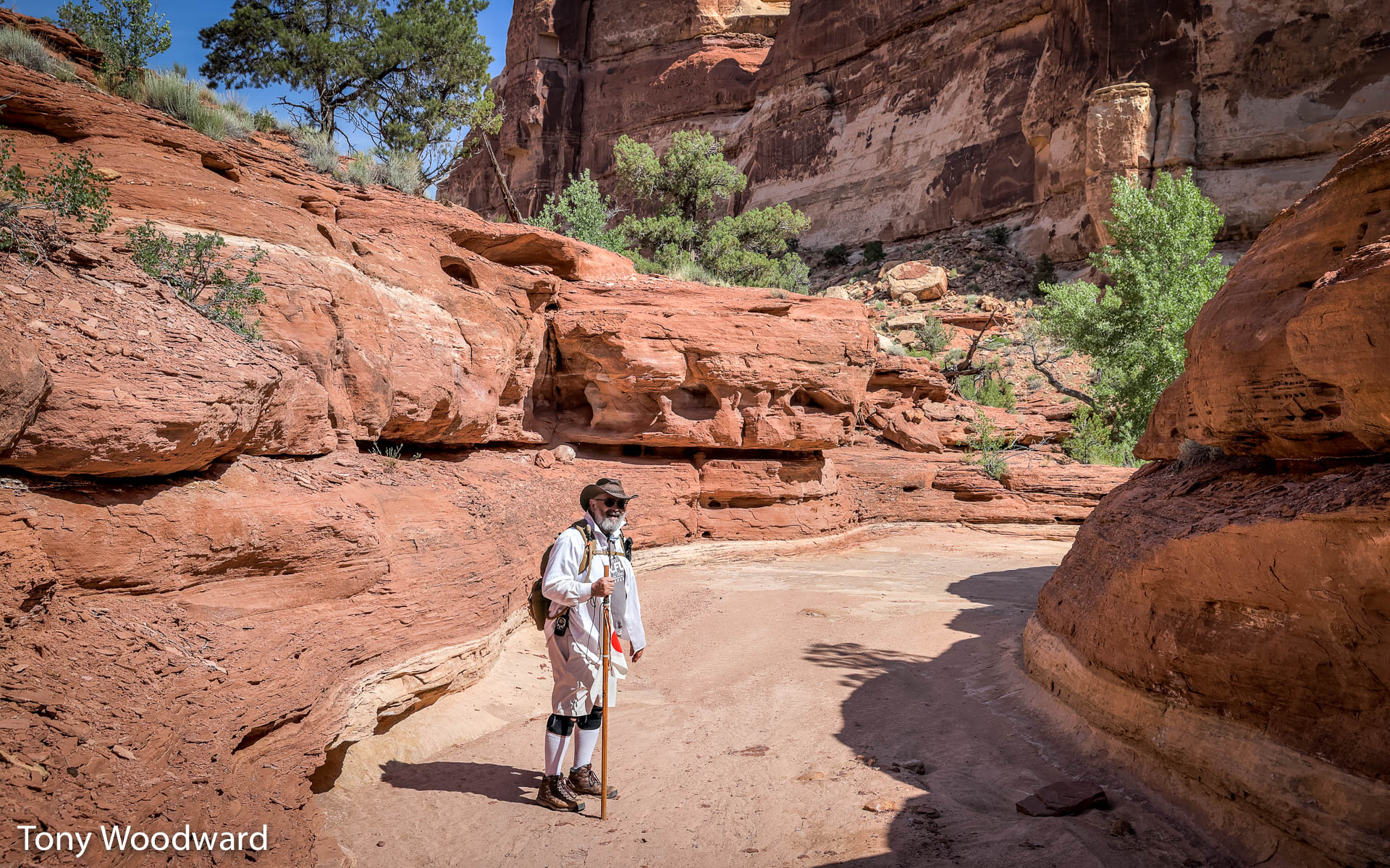
I made sure to bring my 24 year old outback-style hat, which has seen service on four continents:
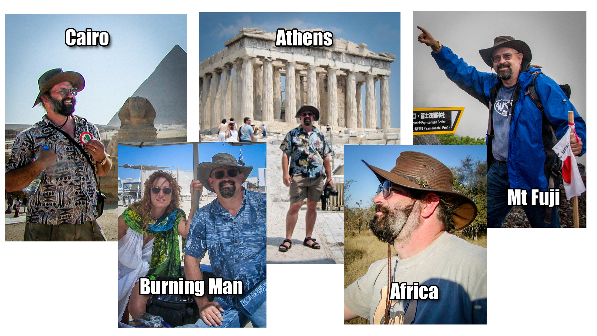
- My "Fuji Stick" (seen above at right)
- My Mount Fuji t-shirt
- The previously mentioned knee supports
- My sun shirt, a large Van Heusen cotton/poly dress shirt
- My Timberland boots
- Two packs of caffeine gum
- ChapStik with 30 SPF sunscreen
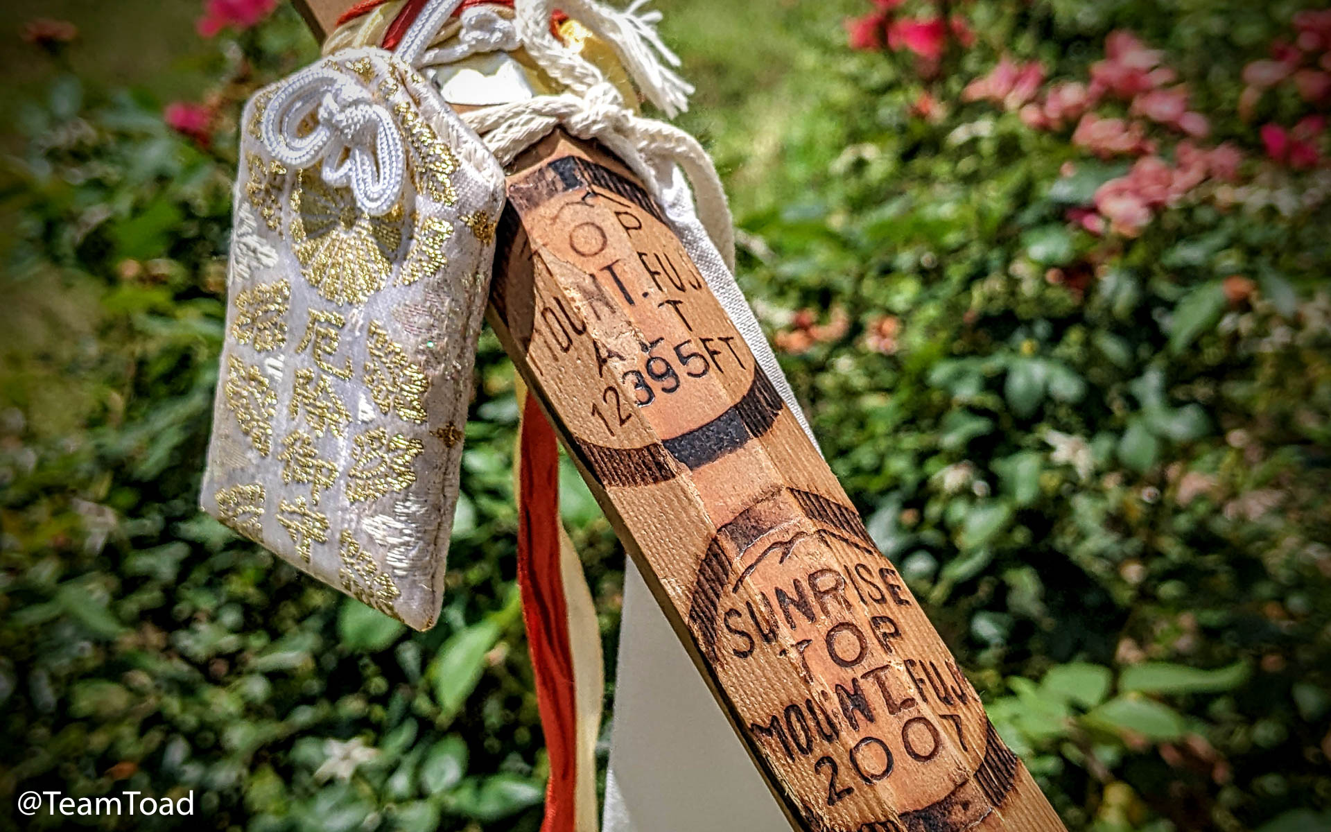 I'd previously used this walking stick to summit Mount Fuji in 2007,
and I wanted to have that same success with the Maze.
I'd previously used this walking stick to summit Mount Fuji in 2007,
and I wanted to have that same success with the Maze.
The walking stick even had a small pouch of herbs blessed at a Shinto temple that was supposed to bring me good luck.
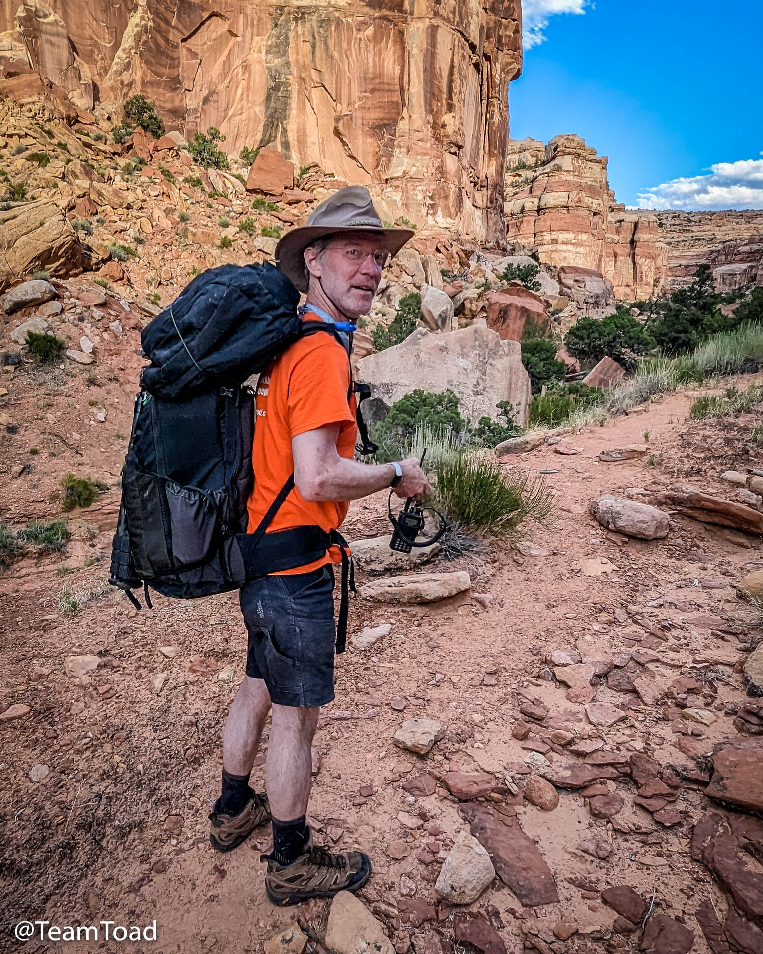
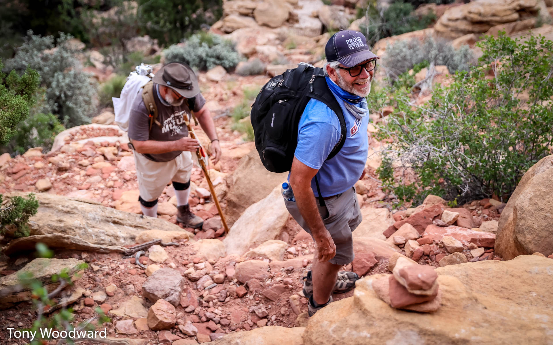
One last addition came from David Rainey: a handheld HAM radio. I carried the GMRS radio, and Tony carried the HAM set. We'd already agreed on a GMRS frequency that he and Barbara would be monitoring during our hike. But having a more powerful HAM radio along would give us yet another way to communicate.
And each of us had an InReach, and we'd already tested the ability to email back and forth over the InReach, so we had three ways to communicate, and one was guaranteed to work.
Theory and Practice
 We had planned to start before dawn, but the drive the day before
was very long, and we pushed our departure back an hour. We woke
at 6am and after some light stretching and packing up, we were
on the trail at 6:23am, right at sunrise.
We had planned to start before dawn, but the drive the day before
was very long, and we pushed our departure back an hour. We woke
at 6am and after some light stretching and packing up, we were
on the trail at 6:23am, right at sunrise.
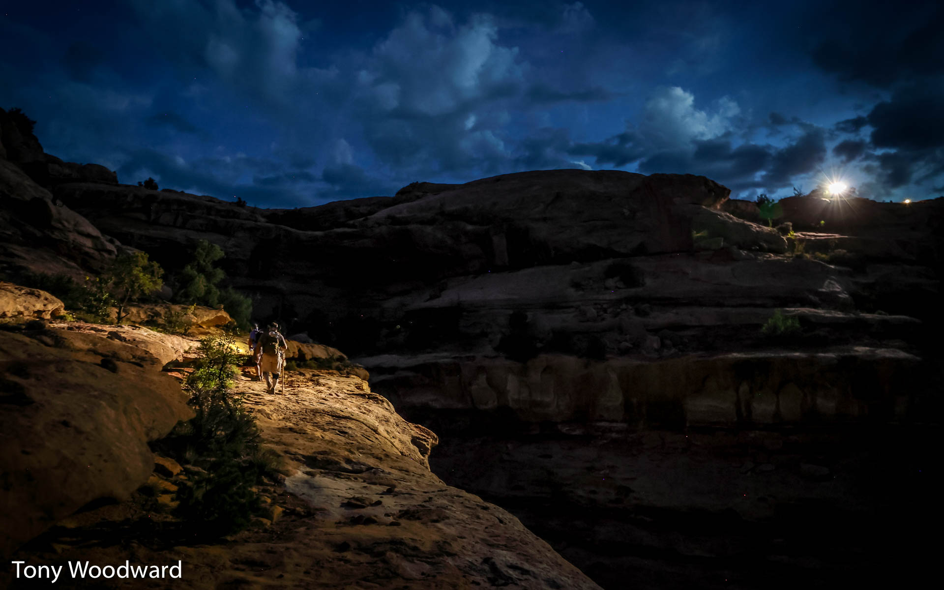
We had scouted the first part of the hike the night before, mainly to verify that our InReach GPS trail map was matching up with the rock cairns the park service had place to mark the trail.
 All the research that I'd done ahead of time said we had roughly
7 miles to hike, and I'd verified that I could hike at 2mph,
so even allowing for delays and rest stops, I figured the whole
thing would take 7 hours, plus an hour shooting at the pictograph.
All the research that I'd done ahead of time said we had roughly
7 miles to hike, and I'd verified that I could hike at 2mph,
so even allowing for delays and rest stops, I figured the whole
thing would take 7 hours, plus an hour shooting at the pictograph.
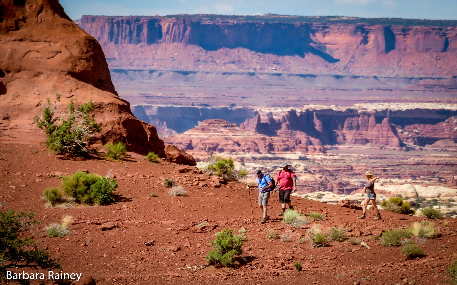
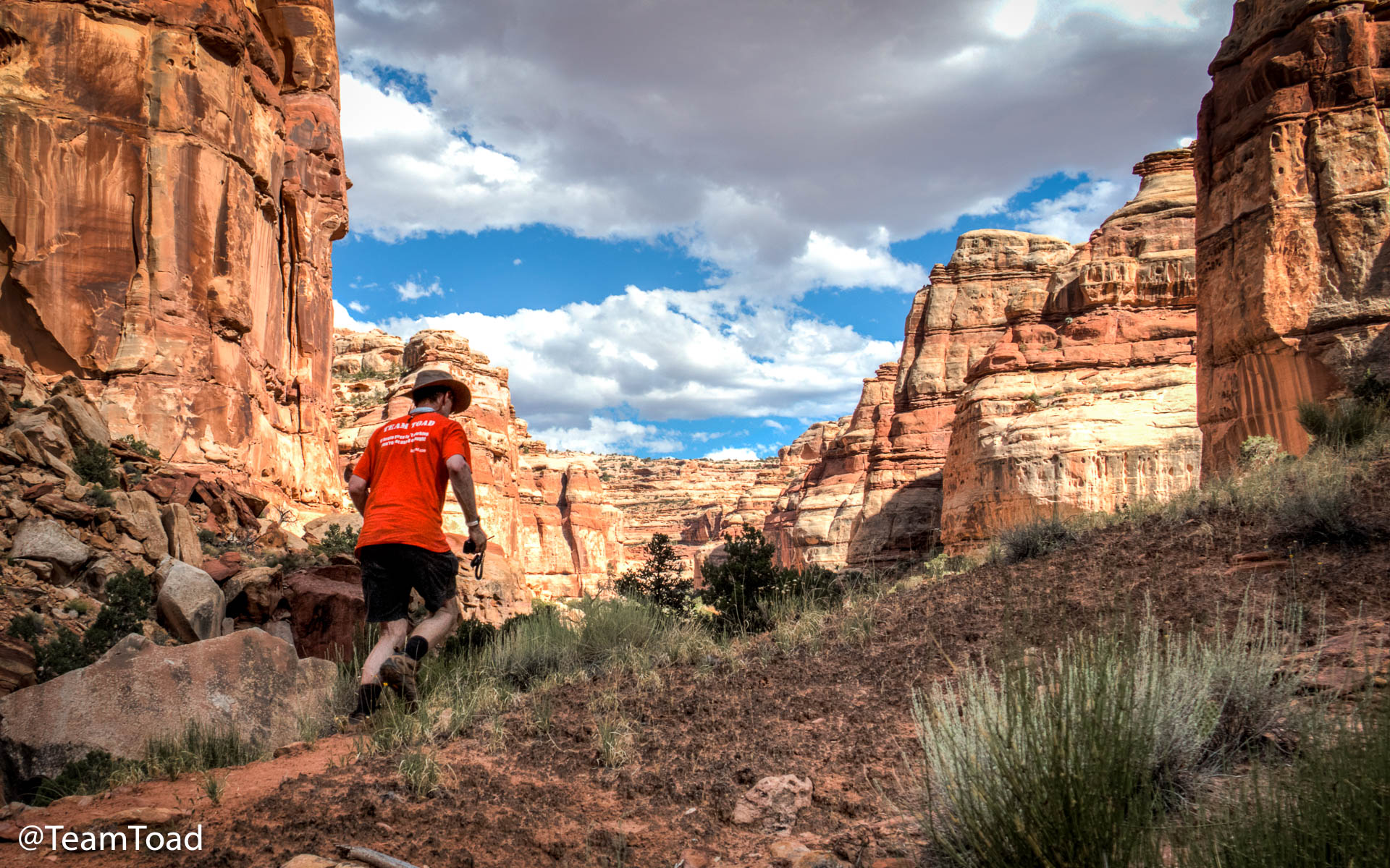
 Things started out well, as they always do in this kind of story.
I'd just hiked to the Confluence Overlook 5 days before, but
the ledges we were encountering below Chimney Rock were much taller.
Things started out well, as they always do in this kind of story.
I'd just hiked to the Confluence Overlook 5 days before, but
the ledges we were encountering below Chimney Rock were much taller.
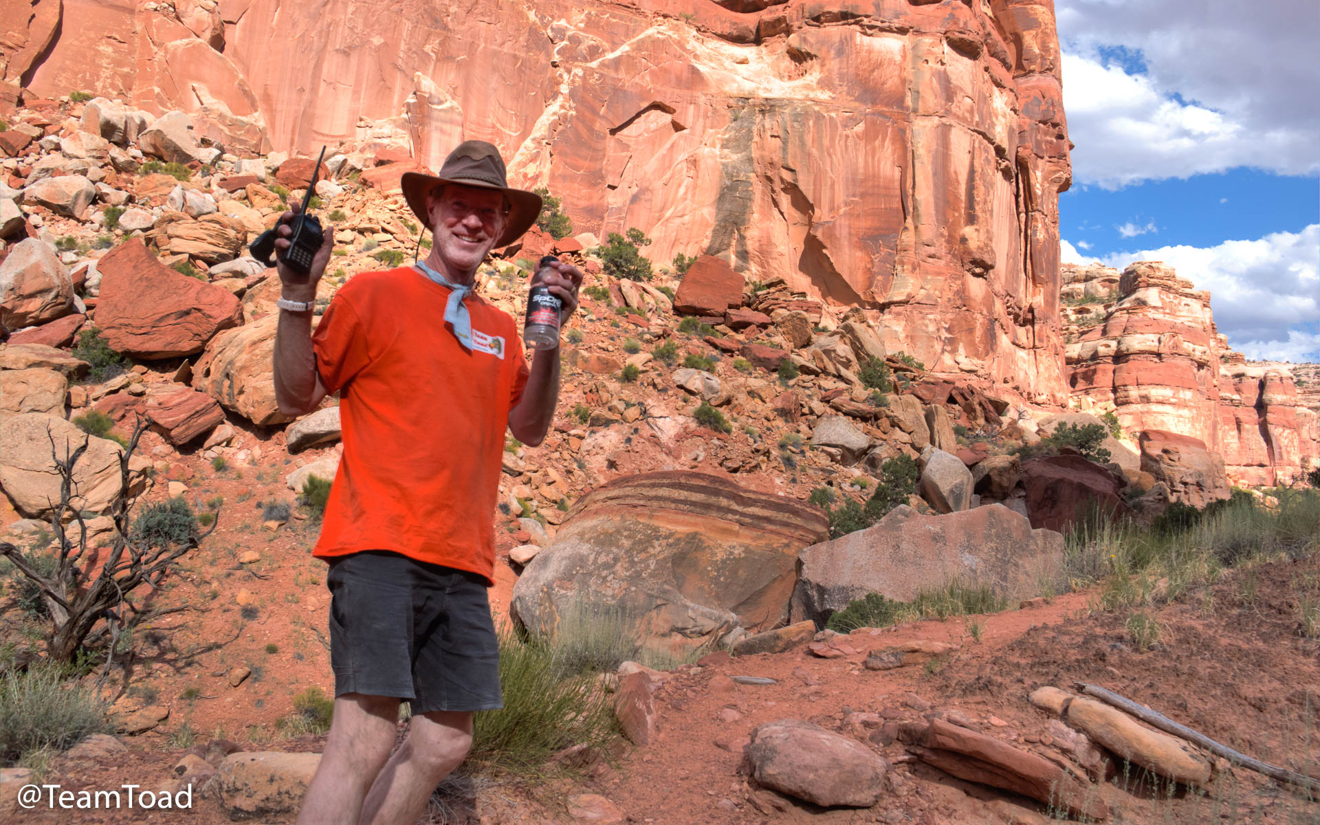
 We were checking in on the GMRS radio every half hour with
Barbara and David back at the base camp. I didn't have spare batteries
for the Midland, so I was only turning it on to check in at
regular times.
We were checking in on the GMRS radio every half hour with
Barbara and David back at the base camp. I didn't have spare batteries
for the Midland, so I was only turning it on to check in at
regular times.
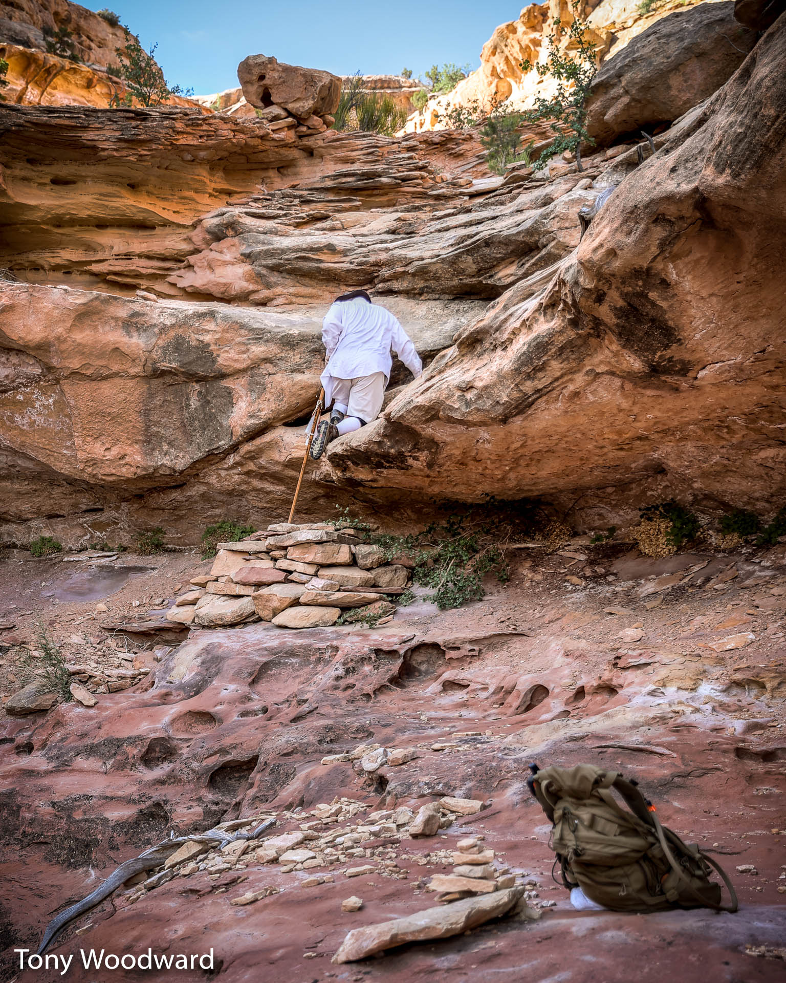
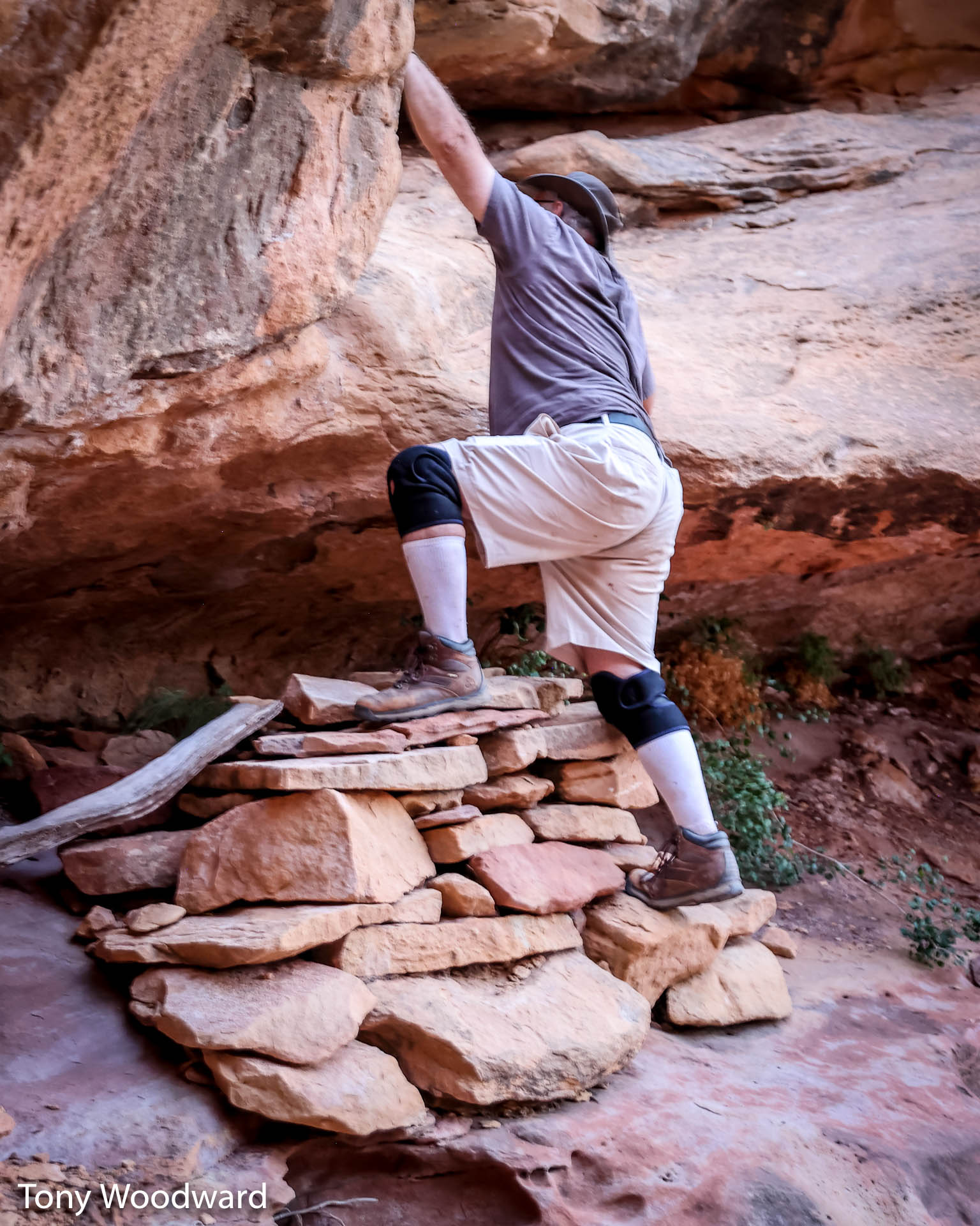
At the 10:30am call I told them we'd come to a large drop, and we were making a "Go, No go" decision. I didn't want to go down anything I couldn't climb back up later.
 Tony looked at it and said the most Jeep thing ever,
"I think I see a way". So he went down first, I lowered
my backpack to him, and slowly lowered myself onto the pile of rocks
that the park service had made part of the trail.
Tony looked at it and said the most Jeep thing ever,
"I think I see a way". So he went down first, I lowered
my backpack to him, and slowly lowered myself onto the pile of rocks
that the park service had made part of the trail.
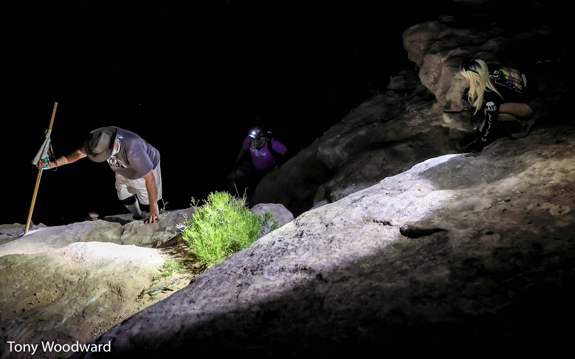
As it turned out, that was actually the worst ledge, and I was able to climb down all the other ledges.
 We made steady progress downward, and reached the canyon floor
after about four hours. I had estimated only 1-2 hours for
this part of the hike, but at least the walk on the canyon floor
would be easier.
We made steady progress downward, and reached the canyon floor
after about four hours. I had estimated only 1-2 hours for
this part of the hike, but at least the walk on the canyon floor
would be easier.
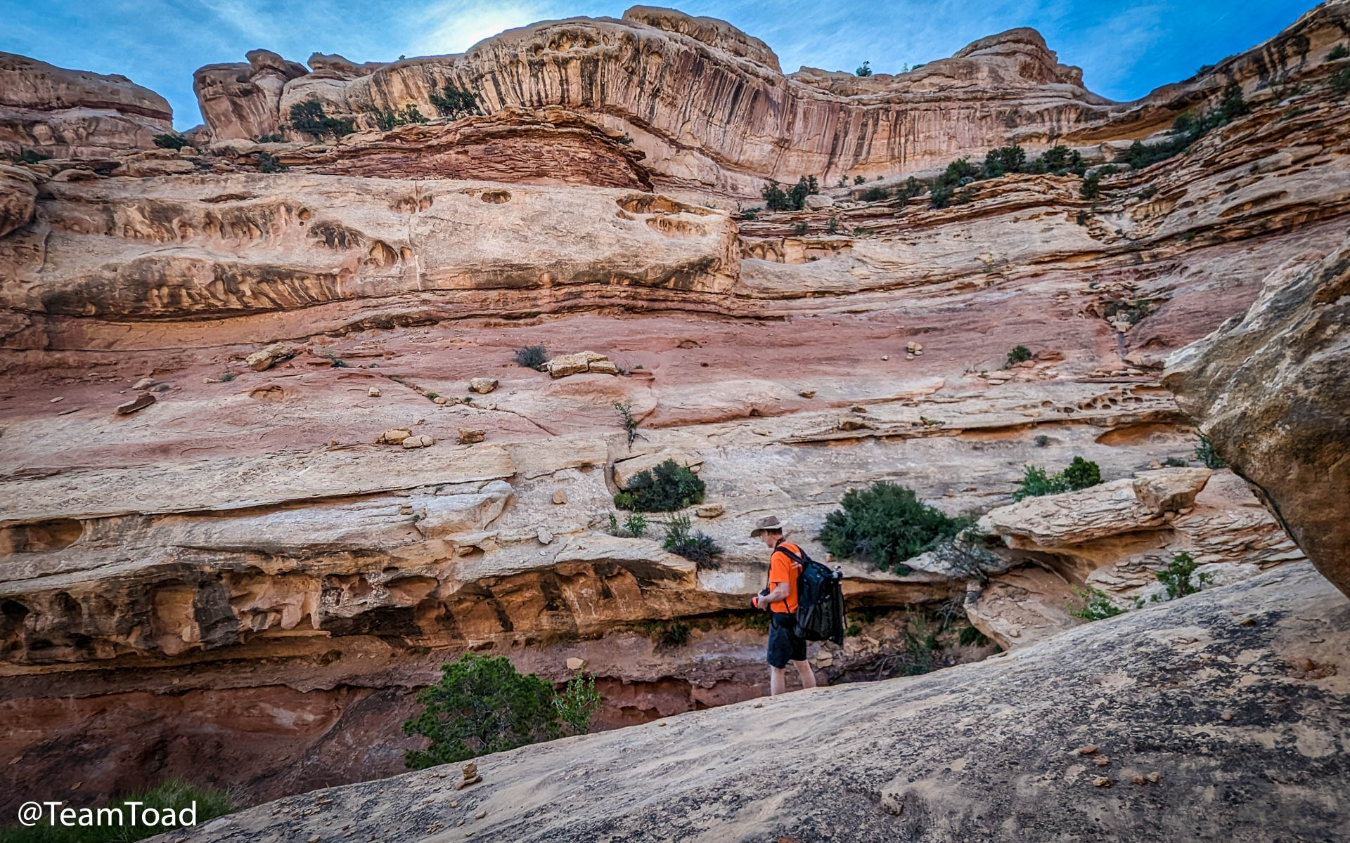
It took 2 more hours to reach the Harvest Scene, and surprisingly the GMRS radio was still able to reach the base camp, albeit with a weak signal. Tony used the HAM set to make our radio checkins.
 Finding the trail at the bottom was a challenge, because the cairns were
few and far between. We tried to follow footprints of recent hikers,
but at one point I wound up following the hoofprints of a big-horned
sheep.
Finding the trail at the bottom was a challenge, because the cairns were
few and far between. We tried to follow footprints of recent hikers,
but at one point I wound up following the hoofprints of a big-horned
sheep.
I figured he lived there and knew the best way.
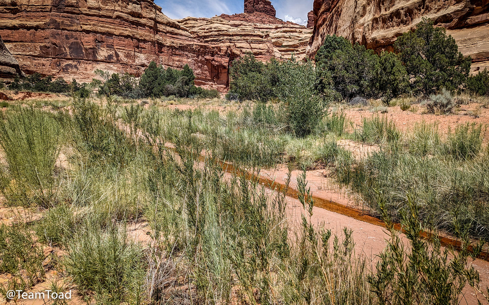 The last half-mile was tough, not because of the terrain, but because
there was actual water in the wash, and with water came flies — biting
flies.
The last half-mile was tough, not because of the terrain, but because
there was actual water in the wash, and with water came flies — biting
flies.
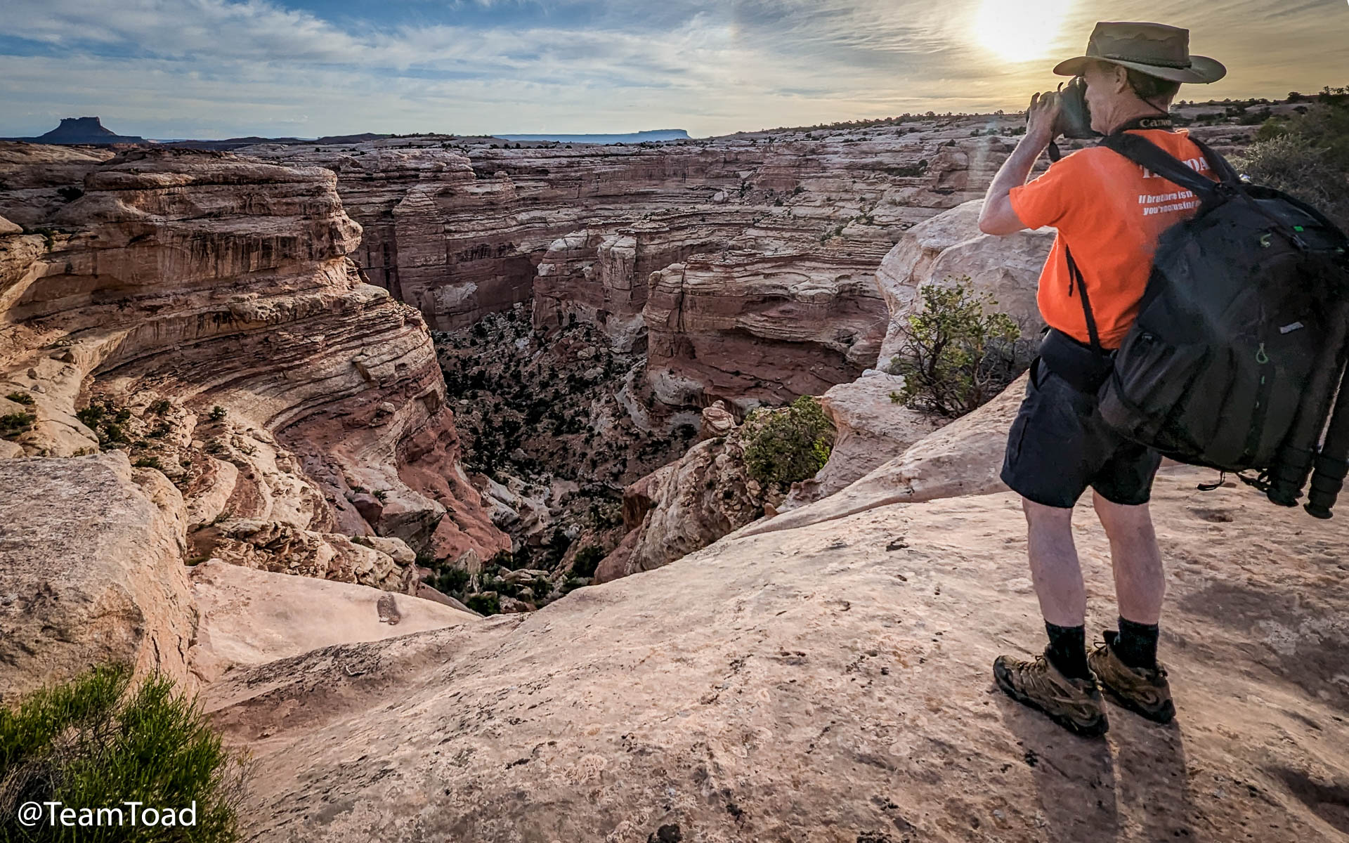
I had my fluffy hand towel, and used it to swat the flies away from my legs, but that took a lot of energy. The flies followed us all the way to the Harvest panel, and foiled my plans to spend a long time carefully photographing the ancient figures.
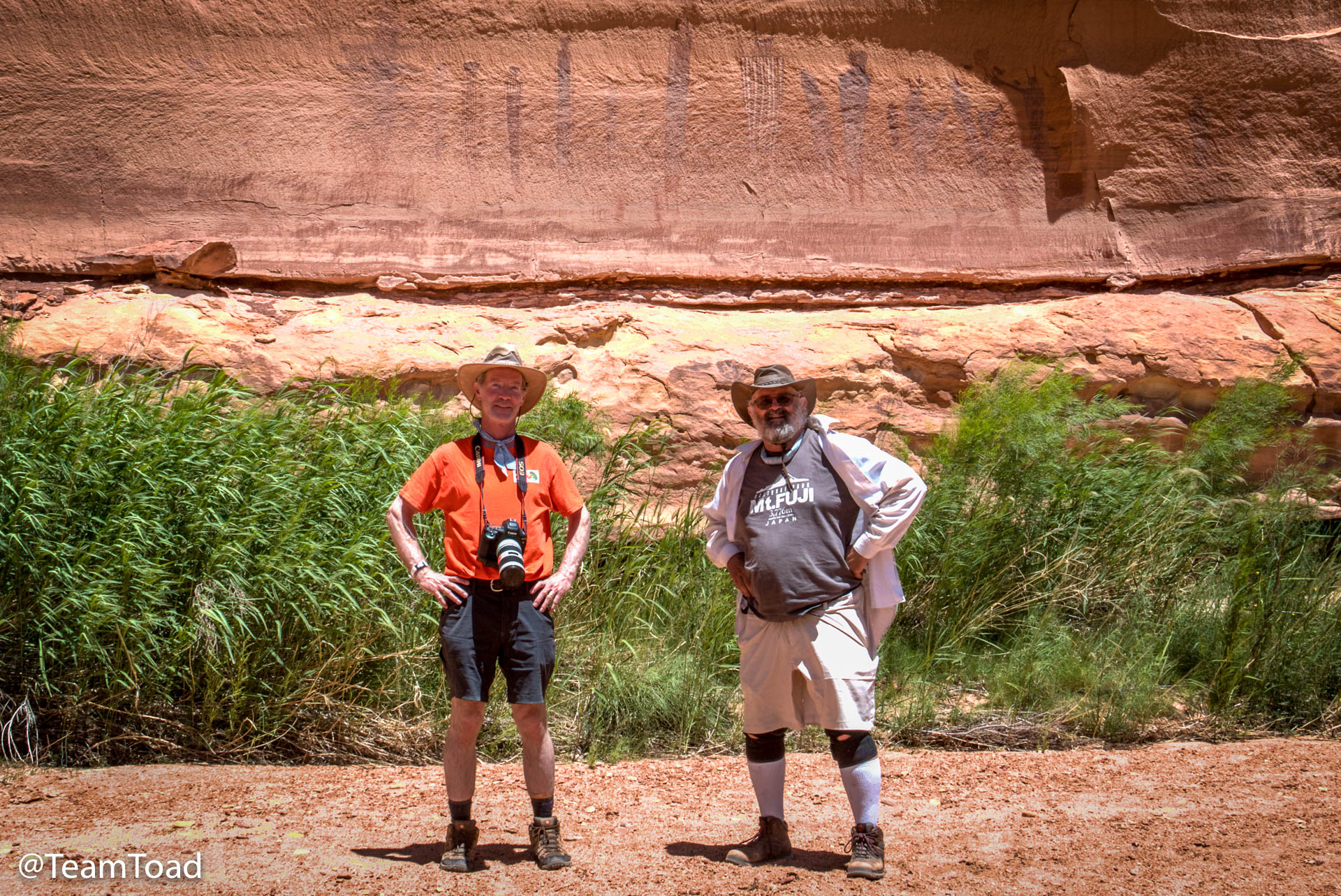
One thing I hadn't realized that direct sun actually makes it harder to see the pictograph figures. The harsh light emphasizes the texture of the rock, not the paint. Ideally we'd have waited for the afternoon when the sun moved westward and the panels would be indirectly lit.
In the end we spent less than half an hour posing and taking pictures. Given that we were three hours behind our original schedule, it was just as well. My slow hiking speed meant we'd have to hike back during the heat of the day.
 Now it didn't feel very hot, with temps in the high 80s, and there
was a good breeze blowing, at least 8-10 mph, and a very low dew
point of 10 degrees Fahrenheit. But that cool breeze was sucking
water out of our bodies rapidly.
Now it didn't feel very hot, with temps in the high 80s, and there
was a good breeze blowing, at least 8-10 mph, and a very low dew
point of 10 degrees Fahrenheit. But that cool breeze was sucking
water out of our bodies rapidly.
Before starting back, I checked my CamelBak, and thought I had about half... the problem is that it's hard to tell by looking how much is really there. I also had a bottle and a half of Gatorade left, so I thought I was doing well.
We headed back about 1:45pm.
Trouble
 The hike back through the wash areas was easy enough, but
I was drinking a lot more than I had on the way out, and
after a couple of hours I checked my CamelBak and found that
I had much less water than I had expected to see.
The hike back through the wash areas was easy enough, but
I was drinking a lot more than I had on the way out, and
after a couple of hours I checked my CamelBak and found that
I had much less water than I had expected to see.
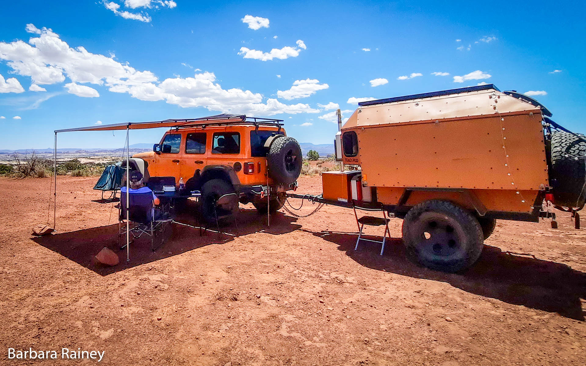
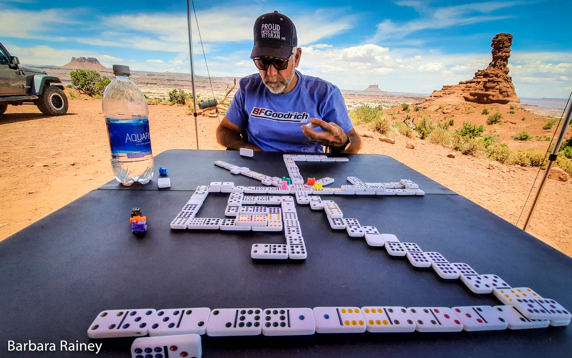 Barbara and David were still holding down the fort at base
camp, playing dominoes and using the ARB awning I'd just
added to the EcoToad. Shade is critical in the Maze, because
there just isn't very much of it... the trees are all down
in the canyons.
Barbara and David were still holding down the fort at base
camp, playing dominoes and using the ARB awning I'd just
added to the EcoToad. Shade is critical in the Maze, because
there just isn't very much of it... the trees are all down
in the canyons.
They were monitoring the radios, handling our checkins, and spending the time by playing Mexican Train, a domino game I'd never heard of.
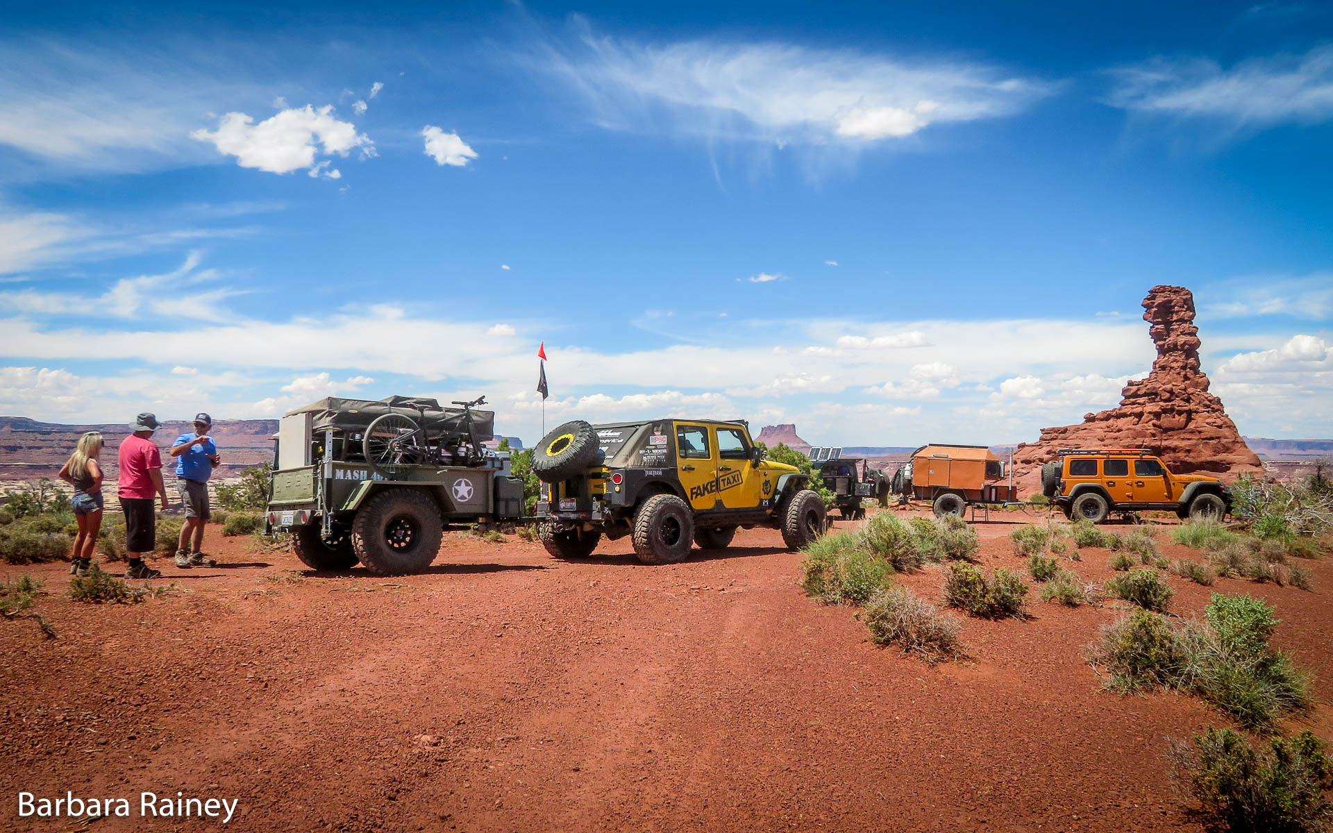
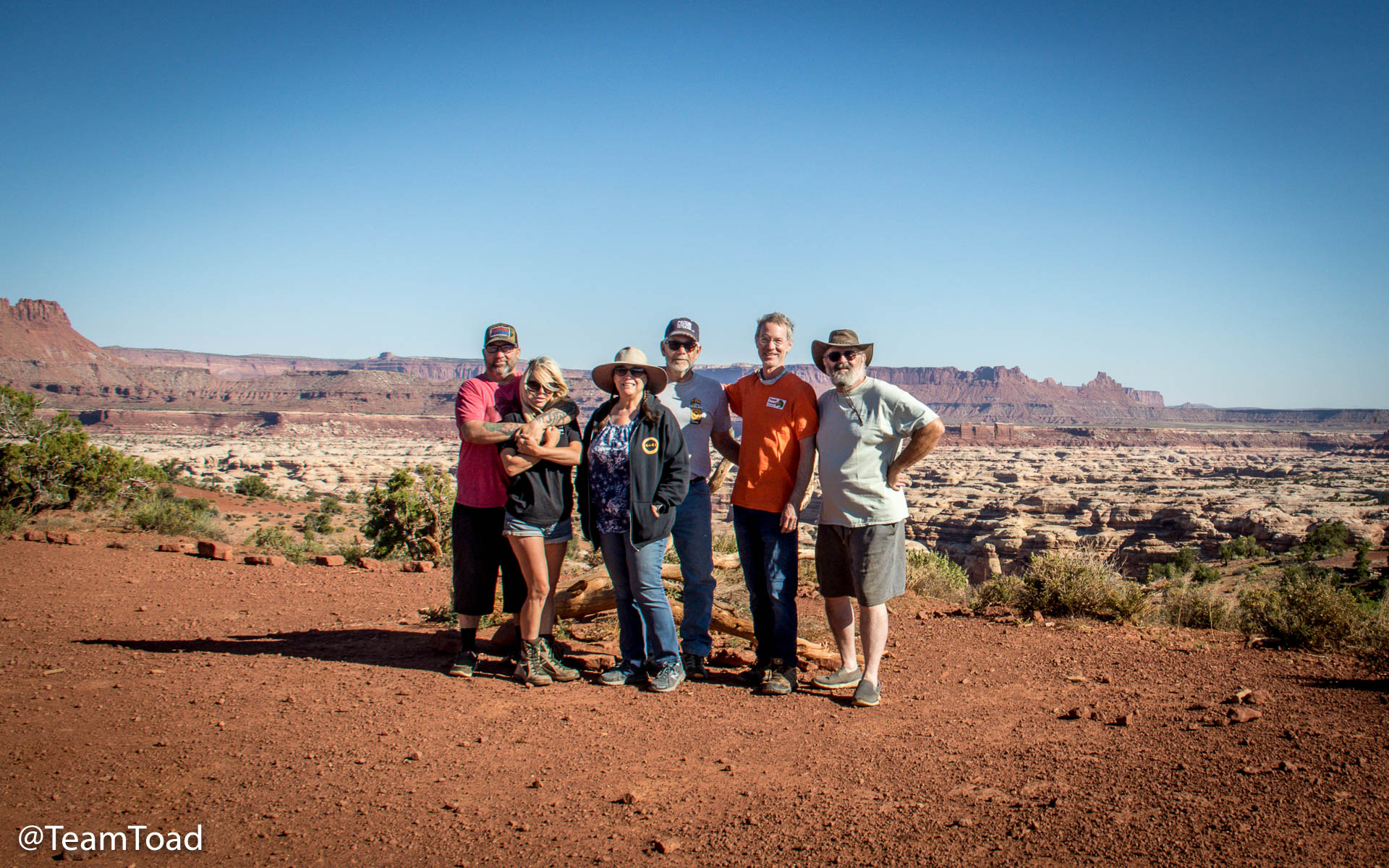
Scotty Maxwell and Wendy Estrada in their overland rig
About 2:30pm they were joined by Scotty Maxwell and Wendy Estrada. They were recent Facebook friends of Barbara's, and just happened to be the only other four wheelers in the entire Maze.
Scotty and Wendy dropped their trailer and drove off to explore the Dollhouse, a campsite just 3 miles away where we'd originally planned to camp that night.
I had verified with the ranger station that no one had a reservation for Chimney Rock Thursday night, so we had the option to just stay in the same camp two nights in a row.
 I didn't take too many photos on the way back, but I did make a point
of turning back and getting this shot of the back-side of the
Chocolate Drops. It's amazing to see them from below like this.
I didn't take too many photos on the way back, but I did make a point
of turning back and getting this shot of the back-side of the
Chocolate Drops. It's amazing to see them from below like this.
Just before the 4pm radio call, I checked my CamelBak and discovered it was nearly empty. At this point I only had about 10 ounces of Gatorade left.
We were about halfway back to camp, but we still had to climb out of the canyon... I realized I was in trouble. Although my core temperature was fine, without enough water I would quickly overheat.
I considered several options:
- I could press on, since I was still well-hydrated.
- I could find shade, rest until the sun went behind the cliff walls.
- I could send Tony for more water, and wait in the shade of a tree or ledge.
Rescue
Having decided that plan 3 would get everyone out of the canyon the soonest, I modified the plan as follows:- At 4pm I radioed base camp and said "I effed up, I'm in trouble. I don't have enough water to finish the hike."
- "Tony and I will continue for now."
- I chose a GPS waypoint on the canyon rim, and used my InReach to send those coordinates to the Rainey's InReach.
- I asked David to bring two gallons of water to the top of the canyon rim at those coordinates.
- At some point, Tony and I would split up, and he would meet David at the canyon rim to bring back the water.
 While Tony and I trudged on, Scotty and Wendy had returned to Chimney Rock
from the Dollhouse. Barbara and David informed them that I was in need
of more water, and that David was planning to carry the requested two gallons
of water to the rendevous point.
While Tony and I trudged on, Scotty and Wendy had returned to Chimney Rock
from the Dollhouse. Barbara and David informed them that I was in need
of more water, and that David was planning to carry the requested two gallons
of water to the rendevous point.
Scotty and Wendy offered to help, and Scotty carried one of the gallons while David carried a pack with another gallon of water, a couple of small bottles of frozen Gatorade, and another one of my Midland GMRS radios.
 Tony and I discussed the issue of where to split up. In theory
it's a simple algebraic problem... F can move at velocity Vf, and
T can move at velocity Vt. What point on the remaining distance
gives the shortest time for for F and T to reach the end?
Tony and I discussed the issue of where to split up. In theory
it's a simple algebraic problem... F can move at velocity Vf, and
T can move at velocity Vt. What point on the remaining distance
gives the shortest time for for F and T to reach the end?
 We walked together for another 90 minutes, and finally
I said, "Okay, here... I'll wait under this ledge".
We walked together for another 90 minutes, and finally
I said, "Okay, here... I'll wait under this ledge".
So at 5:30pm, we dropped our stuff. I sent another GPS waypoint to the Rainey's InReach giving my location. Tony transferred his water from his CamelBak to my two empty Gatorade bottles. He left one with me, and took the other, along with the HAM radio.
While I waited for Tony's return, I had three things to do:
- I needed to send an InReach message to my wife Debbie, who I knew
was likely watching our slow progress across the map on the Garmin
website. She already would have known that we were moving much slower
than planned, and therefore would be a little worried. Seeing the
dot stop moving would have really scared her.
So I sent a text message to her explaining that Tony was going to get more water, and I wouldn't be moving for a couple of hours.
- I took one of the two space blankets and tied it to a tree across the
trail from my shady spot. That way if I passed out or fell asleep it
would be easy for anyone to see my location.
- The hardest thing to do was rest. But I still had to climb out of the canyon, and I didn't want anyone to have to carry me out. So I folded my trusty towel into a pillow and dozed. I was feeling a little guilty, because I still felt fine, and my emotions were telling me to keep moving. But my brain knew that staying put was the thing to do.

Tony's Climb (as told by Tony)
 I left Fuzzy at 5:28pm, and soon after that, turned around to take
the first of many photos of the trail and cairns on my way up, in
case we needed them later for reference. Without my heavy backpack,
I was able to make excellent time.
I left Fuzzy at 5:28pm, and soon after that, turned around to take
the first of many photos of the trail and cairns on my way up, in
case we needed them later for reference. Without my heavy backpack,
I was able to make excellent time.
 I took a wrong turn a few times and had to backtrack a little.
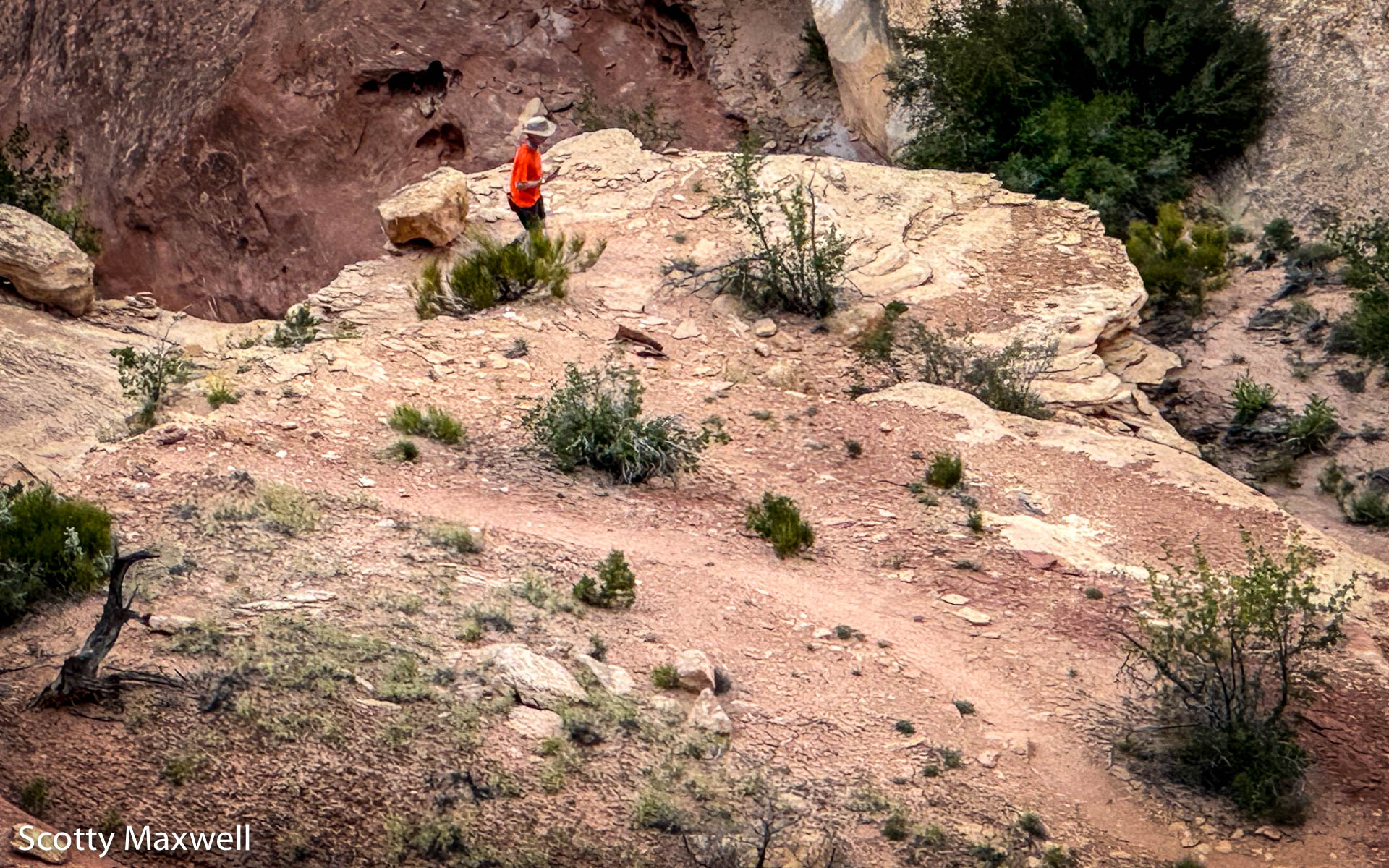
Whenever I'd stop to scratch my head, I could always count on
Scotty to call down course corrections from the rim.
I took a wrong turn a few times and had to backtrack a little.
Whenever I'd stop to scratch my head, I could always count on
Scotty to call down course corrections from the rim.
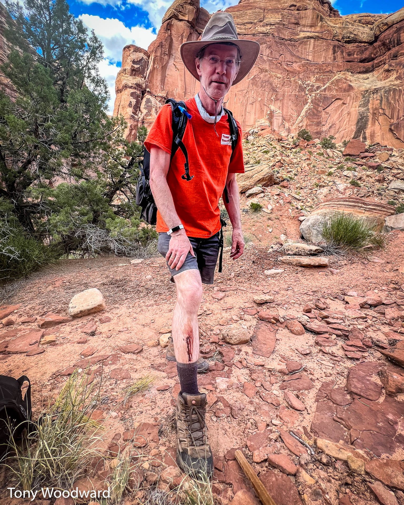 At one point, I tried to walk past a small tree, and ended up impaling
my right shin on a dead, low branch pointed directly at me. I hit it
so hard, the branch broke off the tree and remained sticking out of
my leg. After muttering a few choice words, I yelled up to Scotty that
I was ok, and kept going. I stopped worrying about the bloody mess
once I realized it was just trickling down my leg into my sock.
At one point, I tried to walk past a small tree, and ended up impaling
my right shin on a dead, low branch pointed directly at me. I hit it
so hard, the branch broke off the tree and remained sticking out of
my leg. After muttering a few choice words, I yelled up to Scotty that
I was ok, and kept going. I stopped worrying about the bloody mess
once I realized it was just trickling down my leg into my sock.
 I made it from Fuzzy to the rim (about 1 mile) in 50 minutes!
David, Scotty, Wendy, and I spent a few minutes loading me up with 2
gallons of water, along with some survival equipment (radios with
fresh batteries, first-aid kit, etc.), and I was off again. I made
it back down to Fuzzy in only 28 minutes!
I made it from Fuzzy to the rim (about 1 mile) in 50 minutes!
David, Scotty, Wendy, and I spent a few minutes loading me up with 2
gallons of water, along with some survival equipment (radios with
fresh batteries, first-aid kit, etc.), and I was off again. I made
it back down to Fuzzy in only 28 minutes!
 We rehydrated, refilled our CamelBaks, and redistributed our loads.
After utilizing a little over a gallon of water, we didn't want
to carry any more than we had to, so I poured out the rest into the
sandy dirt. It was absorbed in seconds. Fuzzy strapped David's backpack
to the top of mine, and we were off by 7:30pm.
We rehydrated, refilled our CamelBaks, and redistributed our loads.
After utilizing a little over a gallon of water, we didn't want
to carry any more than we had to, so I poured out the rest into the
sandy dirt. It was absorbed in seconds. Fuzzy strapped David's backpack
to the top of mine, and we were off by 7:30pm.
Not long after starting up the canyon wall, David met up with us! I didn't expect to see him until much later, but it was a real comfort to have his company. He also took some of our load.
 The photos I took came in handy a couple of times, but once it got
dark, everything looked so different, we just had to find our own
way. The headlamps helped immensely toward the end, as did Scotty's
powerful spotlight. There were a couple of times when we were directly
below him that the spotlight actually made it harder to find the
cairns, because they were deep in the shadows. If the daylight had
lasted, we could have gotten back much sooner, but we needed to be
extremely cautious. Some of those ledges and steep inclines were
treacherous enough during the day.
The photos I took came in handy a couple of times, but once it got
dark, everything looked so different, we just had to find our own
way. The headlamps helped immensely toward the end, as did Scotty's
powerful spotlight. There were a couple of times when we were directly
below him that the spotlight actually made it harder to find the
cairns, because they were deep in the shadows. If the daylight had
lasted, we could have gotten back much sooner, but we needed to be
extremely cautious. Some of those ledges and steep inclines were
treacherous enough during the day.
Still or Sparkling?
 Tony says his wife's nickname for him is "The Beast", and it's
well deserved. Tony climbed up the canyon and back down to me in 1 hour and
32 minutes. He's only 4 years younger than me, but he is a lot skinnier
and in much better physical shape.
Tony says his wife's nickname for him is "The Beast", and it's
well deserved. Tony climbed up the canyon and back down to me in 1 hour and
32 minutes. He's only 4 years younger than me, but he is a lot skinnier
and in much better physical shape.
When he got back to me just before 7pm, he draped a little cloth over his arm and asked if I was the gentleman who had orderd the water.
I called Barbara on the radio to tell her that Tony had made it back to me. "I'm saved" I told her.
"Copy that, now come up here and say that to my face" was what she told me.
So after guzzling a frozen Gatorade and a bunch of water, I refilled my CamelBak and we packed everything up for the climb back out of the canyon.
 About a half hour after starting back, we met David coming down the canyon
to help. We redistributed Tony's load between the two of them, and slowly
climbed ledge after ledge.
About a half hour after starting back, we met David coming down the canyon
to help. We redistributed Tony's load between the two of them, and slowly
climbed ledge after ledge.
 I'm sure David was ready to put me over his shoulders if need be, but
I just kept putting one foot in front of the other and climbing back up over
each and every rock we'd climbed down earlier that morning.
I'm sure David was ready to put me over his shoulders if need be, but
I just kept putting one foot in front of the other and climbing back up over
each and every rock we'd climbed down earlier that morning.
I was most relieved when I climbed back up the pile of rocks that had nearly caused me to abort the whole hike earlier in the day.
 We made slow but steady progress, but the sun was setting over the
canyon walls and the sky was getting darker. We broke out flashlights
and kept going.
We made slow but steady progress, but the sun was setting over the
canyon walls and the sky was getting darker. We broke out flashlights
and kept going.
I had decided not to bring my head-lamp, but I had a small flashlight that was light enough to hold in my mouth, and that was more than enough light for me to see where I was going.
 Suddenly the trail in front of us lit up brightly, and we saw that
Scotty and Wendy had brought a spot light and were using it to light up
each cairn in the trail.
Suddenly the trail in front of us lit up brightly, and we saw that
Scotty and Wendy had brought a spot light and were using it to light up
each cairn in the trail.
 Every little bit of light helped, and it was also good to know that there
were people at the top looking out for us.
Every little bit of light helped, and it was also good to know that there
were people at the top looking out for us.
It was about 10pm when I climbed the final ledge, with Wendy and Scotty there holding the spotlight.
We still had about three-quarters of a mile to get back to the Chimney Rock campsite, but we were out of the canyon and therefore "safe".
I stopped to rest and used the InReach to send my wife a note saying we were out of the canyon.
It was close to 11pm when we finally made it back to camp. I went up to Barbara and told her "I'm safe", right to her face. Then I took a selfie with the Toad Pod and sent that to my wife so she could finally relax.
Lessons
The good news is that this story is an adventure, not a tragedy.The most important lesson is that Jeep people, military, and Boy Scouts are great people to know, and there's considerable overlap between those three groups.
I am grateful to Tony Woodward, Barbara and David Rainey, Scotty Maxwell, and Wendy Estrada. You all helped keep me safe and get me back home.
 I'll start with things I did right:
- I had my towel
- I wasn't alone
- We had good navigation (InReach plus paper maps)
- We had good footwear (nobody got blisters)
- We had redundant means of communication
- Multiple people knew where we were and were we were going
- I called for help while I was still in good shape
- I was actually physically capable of doing the whole hike
Now the things I did wrong (these are all on me... I cannot blame anyone else).
- I underestimated the distance and time by over 100%
- I didn't bring enough liquids
- I managed my fluids poorly, drinking too much on the way out
What would I do differently?
- I'd keep at least half of my water in bottles and not the CamelBak bladder
- I'd bring even more water
- I would cache some water at the bottom of the canyon on the way down
- If I'd brought a LifeStraw, I could have collected some of that water from the creek.
What would Tony have done differently? After reading a draft of this report, Tony added some items of his own:
- Brought less gear, especially a lighter tripod, since it was only needed for the selfie with the pictograph
- Brought DEET
- Brought a towel
How did I get the time and distance so wrong?
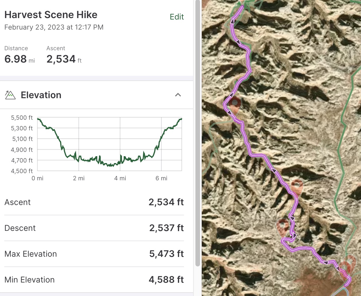
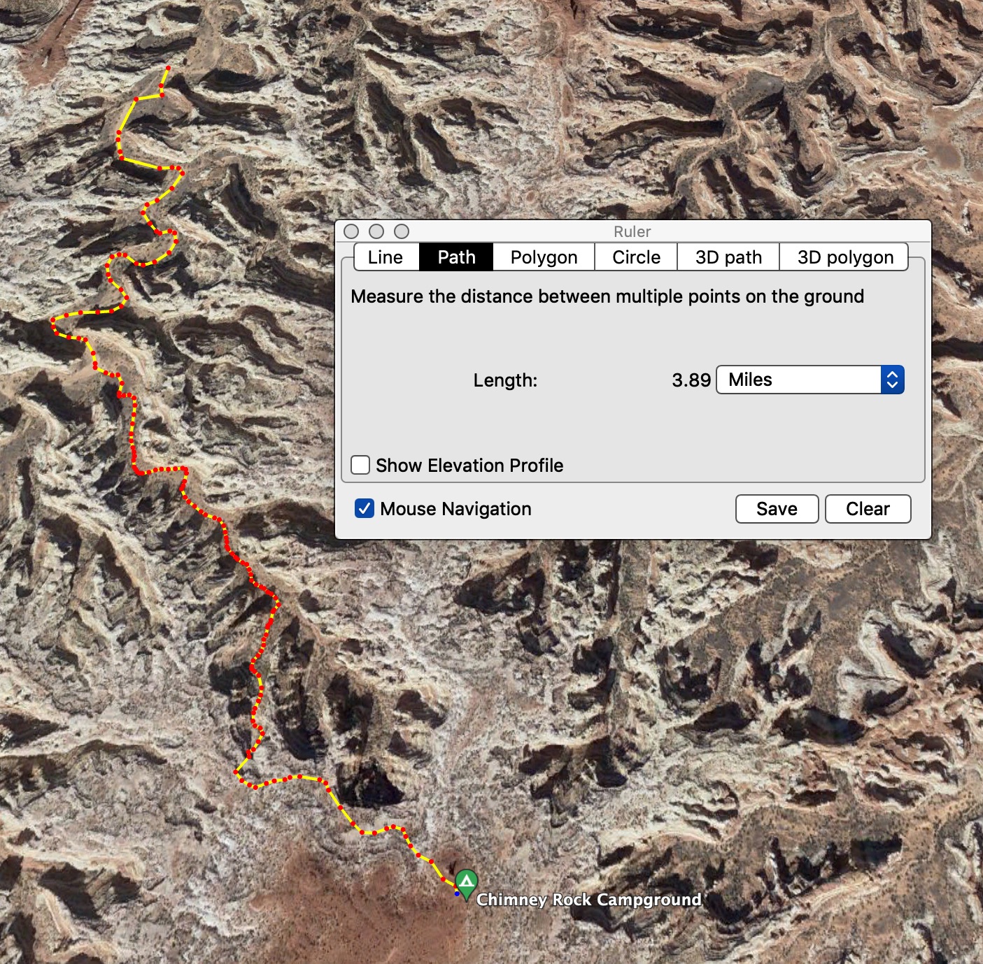
I was using an online hiking map to judge the distance. I had the starting and ending points accurate, and the path calculated was 6.98 miles. But when I got back to camp, my fitness meter on my phone said I'd walked 12.58 miles. Just for confirmation, I used the path tool on Google Earth to check the length of the path, and got 7.78 miles round trip.
This wasn't a problem in the washes or the rest of the canyon floor, but it made for over 5 extra miles of walking.
I checked my fit app while I was waiting for Tony, and I'd already walked over 10 miles. So I was ready and able to go farther than the published distance, just not quite enough farther.
If I'd been more experienced in hiking in the Maze, I'd have probably had a proper fudge factor to estimate the distance better.
I'd done two other hikes up and down before, but both were much shorter distances, and I didn't have digital maps telling me how far to plan.
The Ancient Ones smiled
Barbara had just recently friended Scotty and his "Yellow Jeep" on Facebook, and couldn't really explain how they found each other. The fact that Scotty and Wendy just "showed up" right while Tony and I were hiking is quite a coincidence.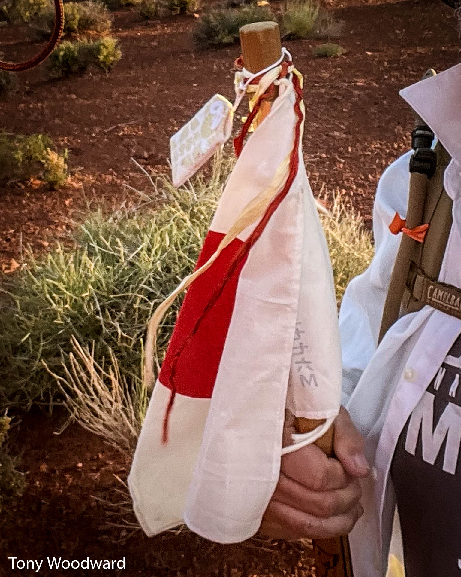 I'm not superstitious, but the last part of the story makes me wonder.
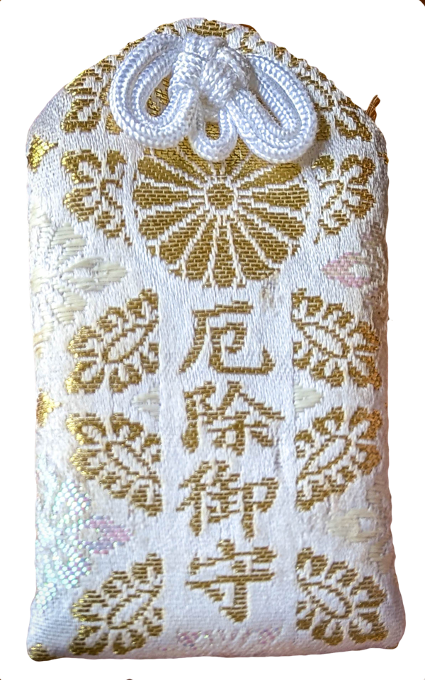
I already pointed out that my Fuji Stick had a white pouch filled with
blessed herbs to bring me good luck. Tony took a selfie of us just
as we left camp, and you can see the pouch tied to the top of my
Fuji stick.
I'm not superstitious, but the last part of the story makes me wonder.
I already pointed out that my Fuji Stick had a white pouch filled with
blessed herbs to bring me good luck. Tony took a selfie of us just
as we left camp, and you can see the pouch tied to the top of my
Fuji stick.
But somewhere in the first 100 yards or so the pouch fell off. That meant that for the entire hike it was missing, and I didn't even notice.
When Wendy returned to camp from the canyon rim to get the spotlight and more radios, she found the pouch on the ground close to camp. She picked it up and handed it to Barbara, assuming it was mine.
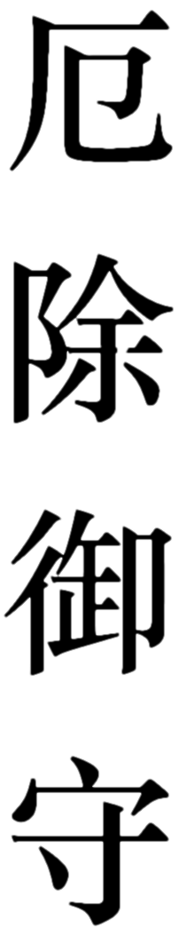
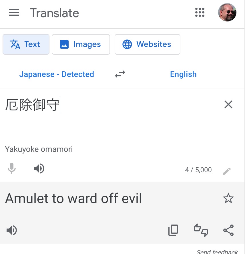
It wasn't until I'd been back home for a week that I took a closeup photograph of the pouch and realized it had writing on one side. With a lot of help from a Kanji character recognition tool, I was able to find the Kanji that matched the writing on the pouch, "Yakuyoke omamori":
|
|
|
Which translates to: "Amulet to ward off evil"
So, obviously the real problem with the hike was that I'd lost the amulet protecting me against evil spirits. Once Wendy had found and given the amulet to Barbara, things turned around and I was rescued.