Lazy Toad Web Pages
Toad Photo Galleries Trails
- Barnwell Mountain
- Black Gap
- Blackrock Desert
- EDRA: Hwy 101
- Elephant Hill
- Engineer Pass
- Fins N Things
- The Maze
- Metal Masher
- Poison Spider/
Golden Spike/
Gold Bar Rim - Rimrocker
- The Rubicon
- Schnebly Hill
- Top of the World
- Toroweap
- White Rim
Other
Team Toad: Engineer Pass, Ouray, Colorado
While driving through Southern Colorado on Hwy 160, I figured I should practice with the Jeep Badge of Honor app. Although I'd done seven badge of honor trails, it wasn't until I got the EcoToad that I'd decided to actually use the app and apply for the badges.
The first time I used the app was on Elephant Hill in June 2023, and I had a difficult time logging in to the app to check in, because you needed internet for the app to log you in with your password, but Jeep trails are often in places with no cell phone coverage.
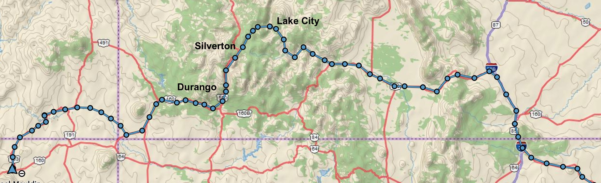
So I stopped along Hwy 160 at a spot with cell coverage, and it said that "Engineer Pass" was only 57 miles away. The trailhead was near Lake City, Colorado, so I got booked a cabin for the night and headed north.
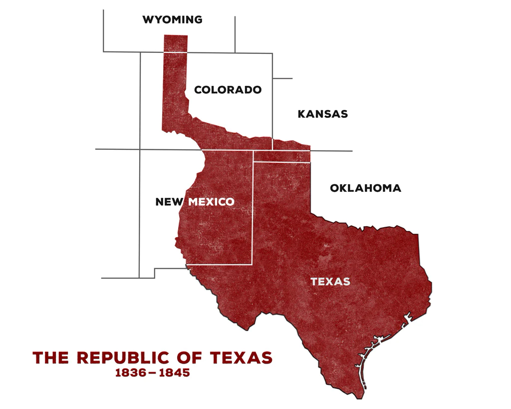 This was actually a fun diversion, because the road followed the Rio Grande river. That meant that I was
still technically "In Texas", even though the signs said "Colorado"
(the map is from Four St James).
This was actually a fun diversion, because the road followed the Rio Grande river. That meant that I was
still technically "In Texas", even though the signs said "Colorado"
(the map is from Four St James).
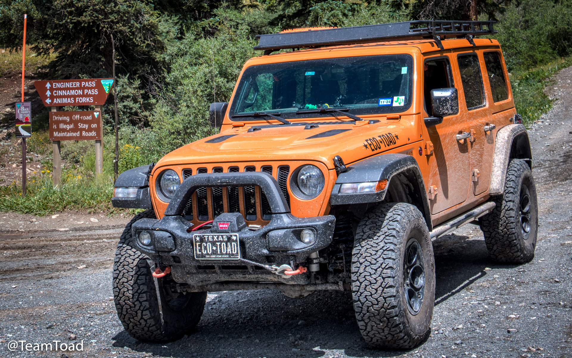
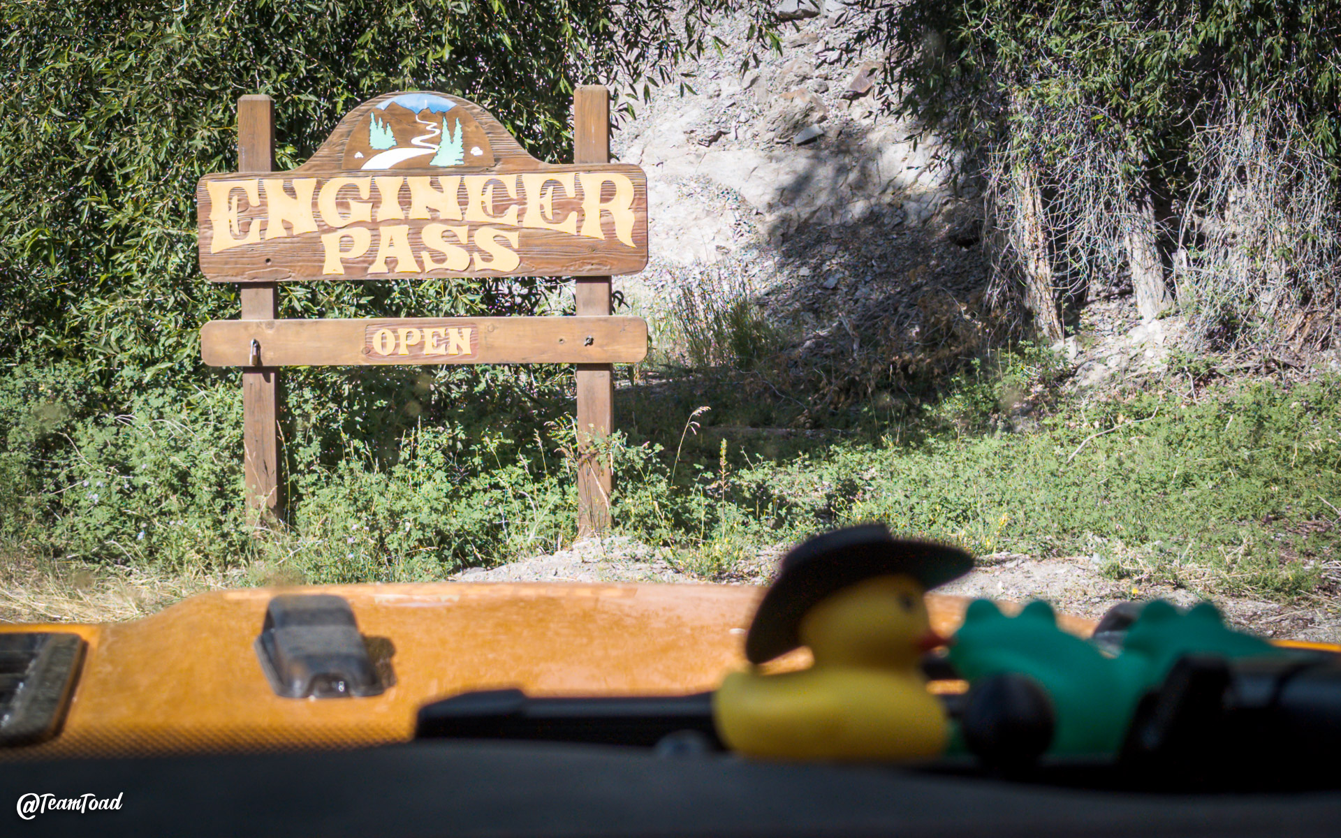 For this trail I didn't need to worry. As soon as I left Lake City, I found the Eastern trail sign
for Engineer Pass, and I still had cell phone coverage, so I was able to check in easily.
I'd left town about 9am, because I wanted to be over the pass by noon. The forecast was
for afternoon thunderstorms.
For this trail I didn't need to worry. As soon as I left Lake City, I found the Eastern trail sign
for Engineer Pass, and I still had cell phone coverage, so I was able to check in easily.
I'd left town about 9am, because I wanted to be over the pass by noon. The forecast was
for afternoon thunderstorms.
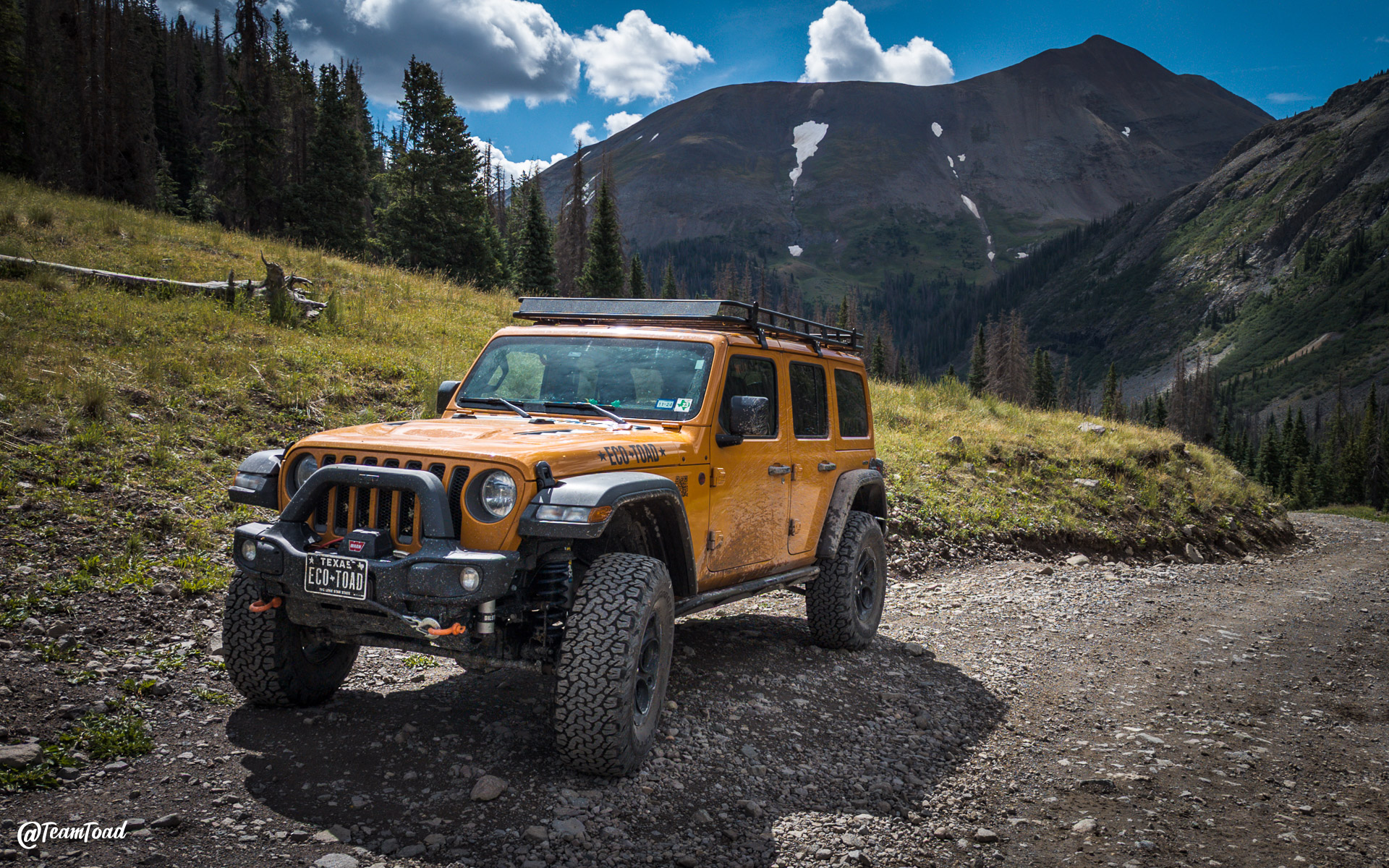
 The trail is basically just Hinsdale County Road 20, but it closes in winter and is not plowed.
It's mostly just a gravel road with beautiful views of mountains, rivers, watercalls, and wildlife
on all aides.
The trail is basically just Hinsdale County Road 20, but it closes in winter and is not plowed.
It's mostly just a gravel road with beautiful views of mountains, rivers, watercalls, and wildlife
on all aides.
 It was pretty busy the day I was there (a Tuesday morning). There were at least two large groups of
side-by-sides on some package tour. I'd pull over and they'd all pass me, then they'd stop at
the few restroom facilities while the kids all had to go to the bathroom, so I'd pass them again.
It was pretty busy the day I was there (a Tuesday morning). There were at least two large groups of
side-by-sides on some package tour. I'd pull over and they'd all pass me, then they'd stop at
the few restroom facilities while the kids all had to go to the bathroom, so I'd pass them again.
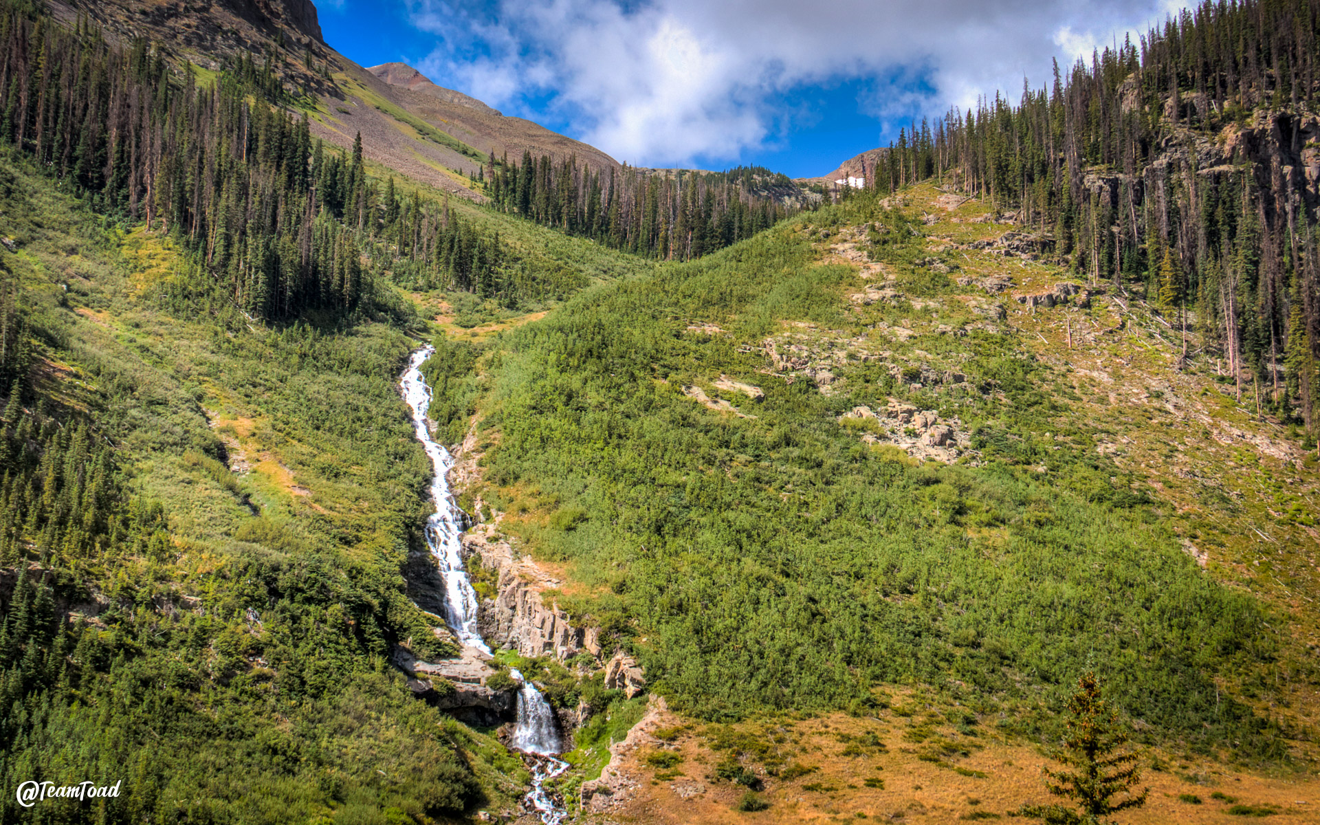
 Colorado is a chellenge for me to visit; I basically want to stop every 5 minutes to take another
photo of another field of wildflowers with a babbling brook and a snow-fed waterfall.
Colorado is a chellenge for me to visit; I basically want to stop every 5 minutes to take another
photo of another field of wildflowers with a babbling brook and a snow-fed waterfall.
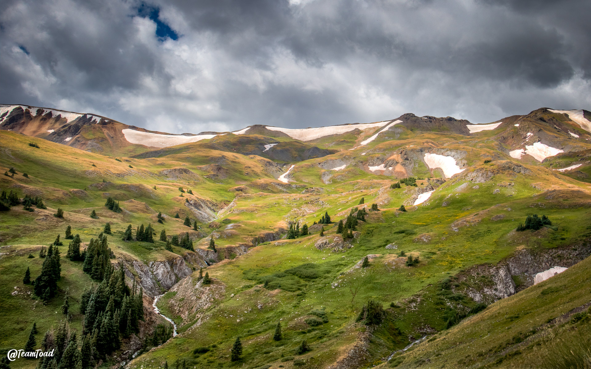
But as you can see from the progression of photos, the sky was getting darker and cloudier with each passing hour.
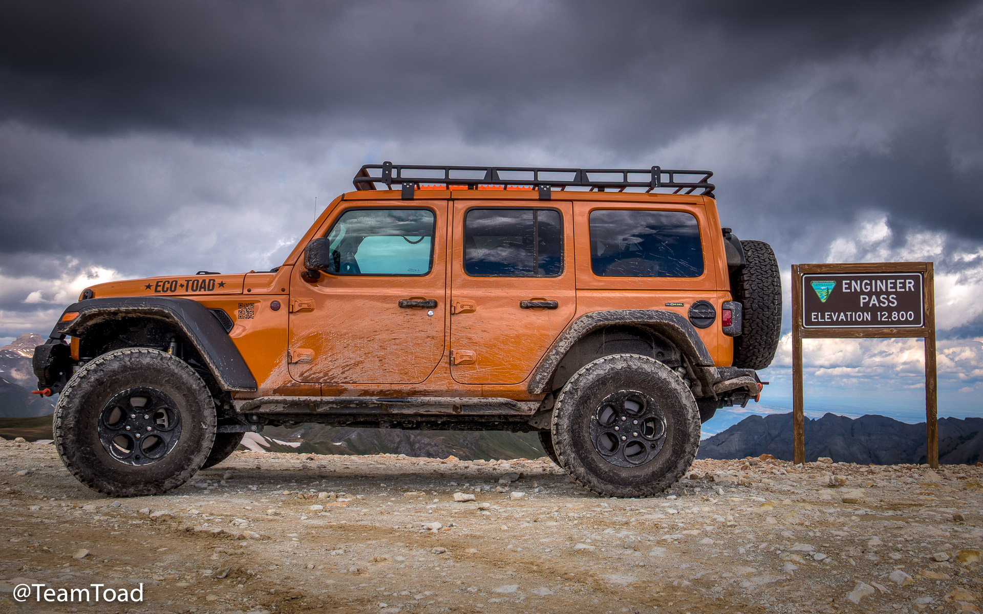
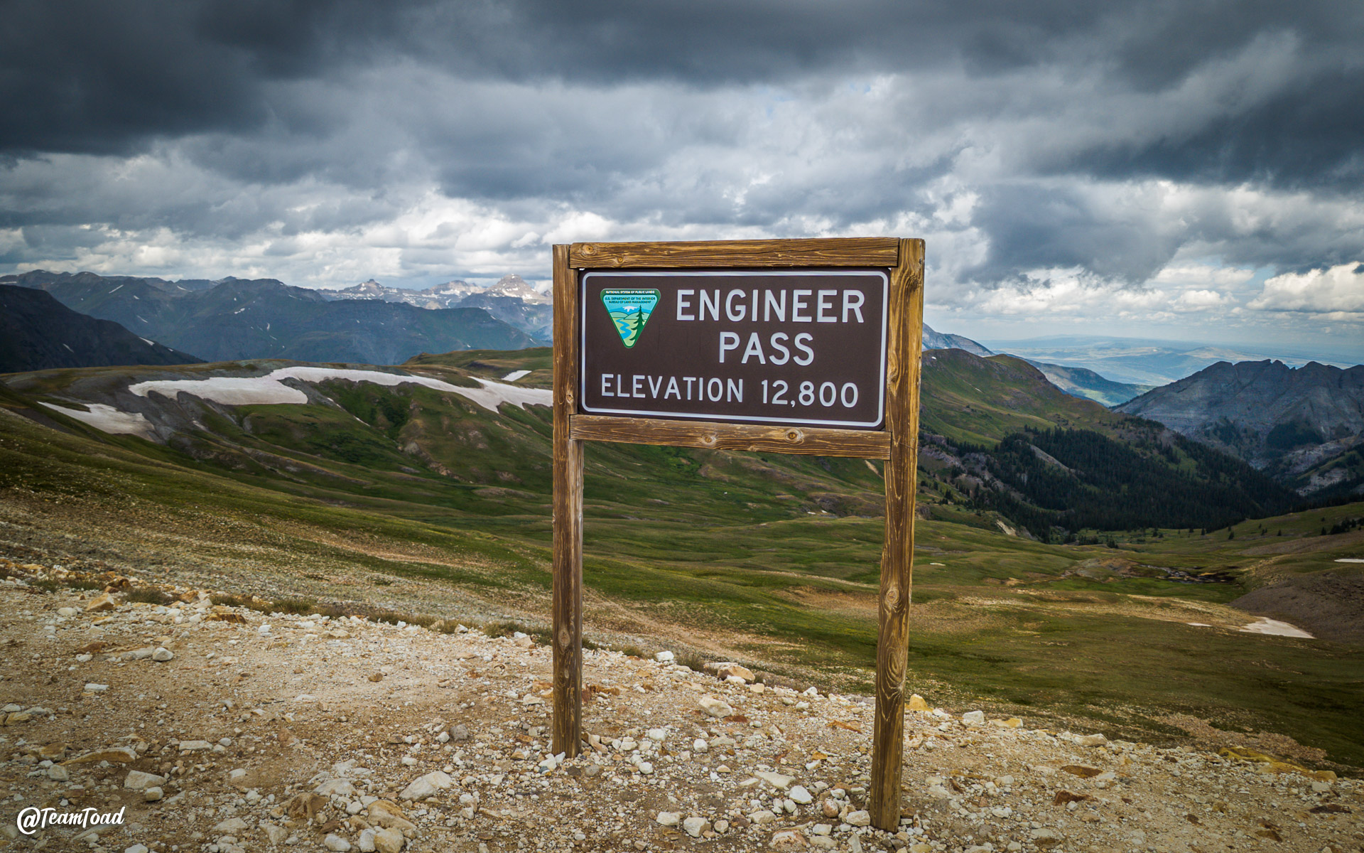
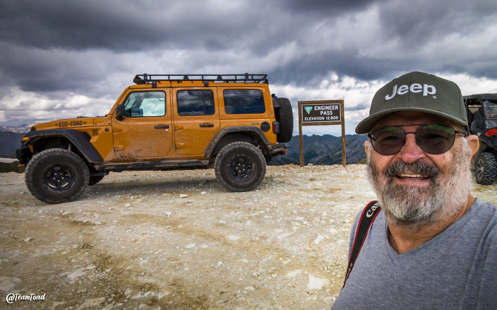 Eventually I made it to the top of the pass for the customary photo opportunity to document that
the EcoToad had climbed to 12,800 feet. You can see how dark the sky
was to the North.
Eventually I made it to the top of the pass for the customary photo opportunity to document that
the EcoToad had climbed to 12,800 feet. You can see how dark the sky
was to the North.
 Once you're West of the pass itself, you have two main choices: North to Ouray, or South to Silverton.
I decided that I'd tempted the weather gods sufficiently, and took county road 2 back Southeast to Silverton.
Once you're West of the pass itself, you have two main choices: North to Ouray, or South to Silverton.
I decided that I'd tempted the weather gods sufficiently, and took county road 2 back Southeast to Silverton.
 Almost as soon as I got over the pass and headed South, I started to see blue skies.
The road down is a "shelf road", meaning that a bulldozer has gouged out part of a hill side to make
a level spot, and pushed the material down over the side.
Almost as soon as I got over the pass and headed South, I started to see blue skies.
The road down is a "shelf road", meaning that a bulldozer has gouged out part of a hill side to make
a level spot, and pushed the material down over the side.
Such roads are typically narrow, meaning there are few spots wide enough for traffic to pass.
n
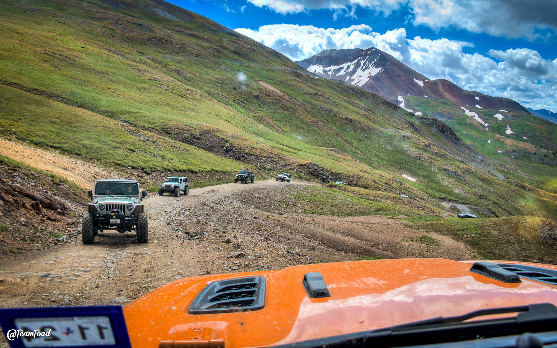
 The road was still busy, as you can see from the group of Jeeps coming up the mountain on their way
to the pass.
The road was still busy, as you can see from the group of Jeeps coming up the mountain on their way
to the pass.
In theory as the down-hill vehicle, I had the right-of-way. In practice as a single vehicle, it was easier for me to find a spot to get out of their way than it was for ten of them to stop.
The trip down to Silverton was again beautiful, scenic, and busy. I didn't find Engineer Pass to be particularly challenging, but of course my rig is highly modified. The main challenge is simply the altitude and peering over a sharp dropoff every now and then.
When I got home two and a half weeks later, my badge of honor had already arrived in the mail.